1 0 0 0 OA 八日と十六時間で世界一周飛行
- 出版者
- 公益社団法人 東京地学協会
- 雑誌
- 地学雑誌 (ISSN:0022135X)
- 巻号頁・発行日
- vol.43, no.11, pp.661a-662, 1931-11-15 (Released:2010-12-22)
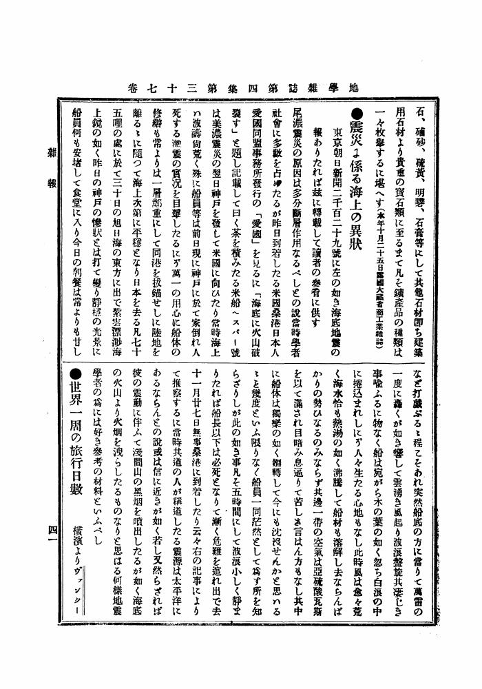
1 0 0 0 OA 世界一周の族行日數
- 出版者
- 公益社団法人 東京地学協会
- 雑誌
- 地学雑誌 (ISSN:0022135X)
- 巻号頁・発行日
- vol.4, no.1, pp.41a-42, 1892-01-25 (Released:2010-12-22)
1 0 0 0 OA 1950~1年三原山噴火の活動状況と研究陣展望
- 著者
- 諏訪 彰
- 出版者
- Tokyo Geographical Society
- 雑誌
- 地学雑誌 (ISSN:0022135X)
- 巻号頁・発行日
- vol.60, no.3, pp.107-114, 1951-09-30 (Released:2009-11-12)
The writer intended here to sketch in broad outline the eruption of Mt. Miharayama, on the island of Oshima, and to have a general view of the works of Japanese volcanologists with reference to the eruption.The eruption was one of·the greatest activities of the volcano in the historical time, characterized by frequent explosions of the Strombolian type.A summit eruption took place suddenly on July 16, 1950, ejecting ash and lava fragments and welling out molten lava, and continued without interruption until September 23. Besides, the volcanic activity resumed on February 4, 1951, and continued incessantly until about the end of March, but it declined and became intermittent at the beginning of April and was completely dead on July 28.During the eruption, a large quantity of new lava flowed out over the rim of the central cone after an interval of 172 years.Nearly one hundred able volcanologists In our country made various invaluable studies on the eruption from geophysical, geochemical, geological and petrological viewpoints.Moreover, the eruption went a long way toward the popularization of scientific knowledge on the volcano and its activity.
1 0 0 0 OA 根室アイヌにおける家構成員の流動性のメカニズム
- 著者
- 遠藤 匡俊
- 出版者
- Tokyo Geographical Society
- 雑誌
- 地学雑誌 (ISSN:0022135X)
- 巻号頁・発行日
- vol.105, no.5, pp.590-612, 1996-10-25 (Released:2009-11-12)
- 参考文献数
- 63
- 被引用文献数
- 2 1
Many old documents show that the Ainu in the Edo period (1603-1867), who were fishers, hunters and gatherers, were a migratory people. It is also widely accepted that the Ainu moved seasonally from their home residences. This probably indicates that the residents of these settlements were relatively stable. But a detailed analysis of other documents shows that two types of mobility were found in Ainu society : inter-settlement movement of households and inter-household movement of the inhabitants. In the Takashima district during the years 1834-1871, the high death rate was the main cause for inter-household movement of the inhabitants. This type of mobility is entitled “Coping Mobility”.The purpose of this paper is to show that during the years 1848-1858 the composition of households in the Nemuro district of Hokkaido varied as a result of inter-household movement of its members, and the main cause for the high mobility was not the high death rate but the high divorce rate.In the Nemuro district, the population of the Ainu decreased dramatically between 1848 and 1852, and then it increased between 1852 and 1858 (Figs. 1 and 2). Their life had already changed depending less on fishing, hunting, and gathering, under the influence of the Wajin. Most permanent residences were located within the same settlements (Fig. 3), but many resident members moved between households (Fig. 4). The number of persons per 100 inhabitants during a 10-year period who moved between households was very large, especially in the Nemuro district and also in the Takashima and Monbetsu districts. But the number was much smaller in the Mitsuishi and Shizunai districts and the southwestern part of Sakhalin (Table 1). The stability of the household members was much lower in the Nemuro, Takashima and Monbetsu districts than in the Shizunai district and the southwestern part of Sakhalin (Fig. 5).Four factors were recognized as main causes for the movement of household members : (1) the death of a spouse, (2) the death of someone other than a spouse, (3) the divorce of amarried couple, and(4) the separation of someone other than a spouse (Fig.8).About 81% (510/631) of the total number of persons who moved between households did so owing to these four reasons. When we include the cases where people moved for two or more reasons, about 68% (349/510) moved because of divorce, and about 94% (481/510) moved because of the divorce and/or the death of a spouse. Persons who moved between households owing to divorce moved individually in most cases, rarely together. When they moved together, they were in most cases unmarried children and their mother (Table 5). About 54 % of the men divorced between the ages of 20 and 34, and about 62% of the women divorced between the ages of 15 and 34 (Fig. 9). The rate of divorce was much higher in the Nemuro district than in the Takashima, Monbetsu, and Shizunai districts and in the southwestern part of Sakhalin (Table 7).The typical pattern of mobility among households is as follows. After a married couple divorced, the former wife moved to another household, usually by herself, sometimes the children would accompany her (sometimes the children would move with the father). In many cases the divorced persons moved to another household to remarry. When they did not move for marriage purposes, they moved to the households where their siblings, fathers and/ or mothers dwelled. This was the first move for the unmarried children. When the unmarried children grew up, they might move to another household for their own marriage. This would be their second move. Then if they divorced, they would move to a third household. In the Nemuro district the inter-household movement of the inhabitants is regarded to have been caused by the high divorce rate. This type of mobility is entitled “Preparative Mobility”.
1 0 0 0 OA プヰプヰアン、ド、サン、マルタンの傳
- 著者
- 鐵椎 學人
- 出版者
- 公益社団法人 東京地学協会
- 雑誌
- 地学雑誌 (ISSN:0022135X)
- 巻号頁・発行日
- vol.16, no.3, pp.203-205, 1904-03-15 (Released:2010-10-13)
1 0 0 0 OA 伊豆・小笠原弧北部域の明神海丘における海底カルデラの形成機構
- 著者
- 村上 文敏
- 出版者
- Tokyo Geographical Society
- 雑誌
- 地学雑誌 (ISSN:0022135X)
- 巻号頁・発行日
- vol.106, no.1, pp.70-86, 1997-02-25 (Released:2009-11-12)
- 参考文献数
- 24
- 被引用文献数
- 6 6
Myojin Knoll Caldera is located on the broad volcanic edifice of Myojin Knoll and is one of the twelve calderas along the front of the Izu-Ogasawara (Bonin) Arc. The caldera floor is about 3×4 km in diameter and lies at a depth of about 1, 400 m.Myojin Knoll is composed of three acoustically defined stratigraphic units, 1A, 1B, and 1C. These are correlated respectively with three lithologic units : stratified volcanic breccia, massive volcanic breccia and rhyolitic lava. These same lithologies were observed during submersible dives using Shinkai 2000. The volume of these units making up Myojin Knoll is Unit1A, 17.5 km3; Unit 1B, 64 km3; and Unit 1C, 48.3 km3.The mean density of Myojin Knoll is about 1.84 g/cm3, based on the calculated volumes and assumed densities of Unit 1A, 1B, and 1C. Using this density for Bouguer corrections, there is neither a high nor a low Bouguer anomaly associated with the caldera. This pattern is more typical of anomalies associated with volcanic craters rather than with Krakatau-type calderas. Three dipole type magnetic anomalies have been recognized, one on the north caldera rim, another on the west rim, and a third on the central cone. The anomaliy associated with the central cone is small, reflecting its relatively small volume.Three mechanisms are suggested for the formation of the Myojin Knoll Caldera : (1) the caldera formed as a pumice cone, (2) it formed by collapse of the pre-caldera stratovolcano that formed Units 1B and 1C, and (3) it formed by the destruction of the pre-caldera stratovolcano as a result of the explosive eruption of the huge volume of pumice associated with Unit 1A. The gravity and magnetic data presented here suggest that the models of the pumice cone and the explosive destruction of the pre-caldera stratovolcano are preferable to the model of a collapsing stratovolcano.
1 0 0 0 OA 東京臨海部における港湾再開発と土地利用変化の特性 ―東京都港区海岸地区を事例に―
- 著者
- 太田 慧
- 出版者
- 公益社団法人 東京地学協会
- 雑誌
- 地学雑誌 (ISSN:0022135X)
- 巻号頁・発行日
- vol.124, no.4, pp.525-544, 2015-08-25 (Released:2015-09-17)
- 参考文献数
- 24
Changing land use patterns are clarified from time and space points of view. Relationships are revealed between changing land-use patterns and port functions in the Kaigan area of the Tokyo waterfront, Minato Ward, Tokyo Metropolis. After Tokyo port opened in 1941, the Tokyo waterfront area was used mainly for logistics facilities, such as warehouses and port facilities. However, since the 1960s, the logistics system in the port has been changed by containerization. Port facilities in the Tokyo waterfront area became outdated. In response, the Tokyo waterfront area was redeveloped in the mid-1980s. As a result, significant changes to land use occurred in the Tokyo waterfront area. This study selects three target years, 1985, 1996, and 2012. A mesh analysis is conducted of land use in the Kaigan area, Minato Ward, Tokyo district. From 1985 to 1996, the port policy changed land use in the port district away from logistics facilities, including warehouses and port facilities. From 1985 to 1996, vacant land for redevelopment increased during the period of the asset inflation-led bubble economy. In comparison with the period from 1985 to 1996, during the period of from 1996 to 2012, land use changes in the port district ceased and changes outside the port district continued. These are connected to changing port functions. Since the 2000s, the number of passenger ships using Takeshiba pier has increased, promoting changes to urban land use in the surrounding area. On the other hand, at Shibaura pier, the number of the cargo ships entering remains unchanged, and land in the vicinity has continued to be used for logistics facilities such as warehouses and port facilities. Consequently, relationships are suggested between changing land-use patterns and port functions.
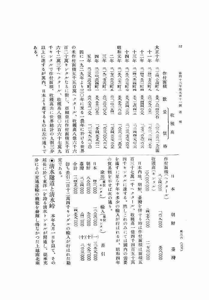
1 0 0 0 OA 清水燧道と清水峠
- 出版者
- 公益社団法人 東京地学協会
- 雑誌
- 地学雑誌 (ISSN:0022135X)
- 巻号頁・発行日
- vol.43, no.9, pp.536-538, 1931-09-15 (Released:2010-12-22)
1 0 0 0 OA 陸上温泉に潜む難培養性・好熱性アーキアの探索
- 著者
- パシットフティサク ウィプー 柳川 勝紀
- 出版者
- 公益社団法人 東京地学協会
- 雑誌
- 地学雑誌 (ISSN:0022135X)
- 巻号頁・発行日
- vol.131, no.6, pp.647-663, 2022-12-25 (Released:2023-01-12)
- 参考文献数
- 97
- 被引用文献数
- 2
Previous single-gene surveys using 16S rRNA gene-based methods have revealed the phylogenetic classification, distribution, and diversity of as-yet uncultivated microbial lineages in diverse environments. In particular, archaeal communities associated with high-temperature terrestrial hot springs and sediments are dominated by novel thermophilic and hyperthermophilic populations whose physiological characters and ecological roles are unknown. Recent advances in metagenomic approaches and computational processing of huge volumes of DNA sequence data have further unveiled the evolutionary importance of uncultivated hot spring archaeal lineages and previously undescribed roles in biogeochemical cycles of carbon, nitrogen, sulfur, and metals. In this review article, the uncultured thermophilic and hyperthermophilic archaeal lineages that have accelerated our understanding of the tree of life are illustrated.
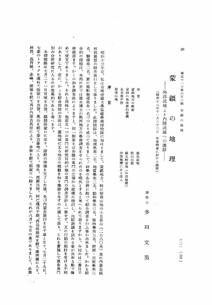
1 0 0 0 OA 蒙彊の地理 外洋流域より内陸流域への遷移
- 著者
- 多田 文男
- 出版者
- 公益社団法人 東京地学協会
- 雑誌
- 地学雑誌 (ISSN:0022135X)
- 巻号頁・発行日
- vol.51, no.5, pp.231-243, 1939-05-15 (Released:2010-10-13)
1 0 0 0 OA 東京における眺望景観の過去・現在・未来
- 著者
- 岡村 祐
- 出版者
- 公益社団法人 東京地学協会
- 雑誌
- 地学雑誌 (ISSN:0022135X)
- 巻号頁・発行日
- vol.122, no.6, pp.1056-1069, 2013-12-25 (Released:2014-01-16)
- 参考文献数
- 26
- 被引用文献数
- 3 4
Views within and from a city make spatial experiments productive. These views make it easier to understand the importance of the image of a city as several urban planners and designers have indicated. On the basis of literature reviews and data gathered from the author's research on views in Tokyo, this paper establishes four phases, namely “foundation,” “creation,” “obscuration,” and “conservation” for views in Edo and Tokyo in an urban transformation context. First, in the foundation phase, this paper focuses on mountain vistas. Block planning in the early Edo period is considered to have been affected by the orientations of Mt. Fuji, Mt. Tsukuba, and a small hill inside the urban area. It also covers views within places of interest that attracted artists, and indicates such undulating landscapes were chosen deliberately. Second, this paper analyzes some views created under modern town planning and urban design systems and techniques, specifically those based on baroque-style urban design in which some vistas of monumental structures such as the Diet Building and Tokyo Station were embedded into the existing urban space. Furthermore, new views created when developing public spaces utilizing existing views or existing monuments reconstruct the spatial order. Third, many views have been obscured in central Tokyo, where building space has become increasingly dense. Furthermore, views of landmarks have also been blocked or restricted by new buildings. Nowadays, there are few Fujimi slopes from which we can command a view of Mt. Fuji. Moreover, vistas and landscapes of traditional Japanese gardens have been artificially disturbed by developments in their settings. Finally, in the conservation phase, Tokyo metropolitan government and local authorities of their respective wards have introduced a system, which we call the “View Conservation Plan,” since the “Landscape Act” was established in 2004. Some vistas of an outstanding monument, landscapes of traditional Japanese gardens, and several local views have at last been recognized to require protection. However, these plans are still at an early stage and we have yet to verify their effectiveness. Furthermore, we must continue to improve views in terms of both theory and management techniques. On the basis of these discussions, this article concludes that we need sophisticated theories and techniques of view management planning particularly to consider how we can create new views, while taking into account existing urban issues, and we need to come up with ideas for taking advantage of views as local resources to raise a shared awareness of the importance of views in our daily experiences.
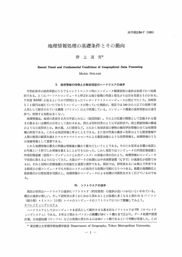
1 0 0 0 OA 地理情報処理の基礎条件とその動向
- 著者
- 野上 道男
- 出版者
- Tokyo Geographical Society
- 雑誌
- 地学雑誌 (ISSN:0022135X)
- 巻号頁・発行日
- vol.94, no.7, pp.581-585, 1986-01-25 (Released:2009-11-12)
- 参考文献数
- 9
1 0 0 0 OA 関東地方における旧軍用飛行場跡地の土地利用変化
- 著者
- 松山 薫
- 出版者
- Tokyo Geographical Society
- 雑誌
- 地学雑誌 (ISSN:0022135X)
- 巻号頁・発行日
- vol.106, no.3, pp.332-355, 1997-06-25 (Released:2010-04-23)
- 参考文献数
- 34
- 被引用文献数
- 4 4
Military establishments are special kinds of public facilities which are not oriented to common users and are under direct government control. To verify their strong spatial influence, the author reviewed a series of policies on the disposal of national properties, and studied changing land use of the former military airfields in the Kanto District.With the end of World War II, a large number of military establishments and properties all over Japan lost their functions. Many of them were released for public use and others were taken over by U.S. military. Their disposal was affected by three groups of government policies : fundamental laws on the disposal of national property exercised by the Finance Ministry; several policies on postwar reconstruction, industrial promotion, regional development, etc. ; and the occupation policies with military purposes and defense policies based on the Security Treaty between Japan and U.S.A.Based on the investigations covering 60 airfields in the Kanto District, the author has found that three stages characterize the major patterns of land use conversion.In the first stage (1945-1960), most of the former Japanese military airfields became farmlands for food supply and unemployment relief under the reclamation policy. The other airfields, especially those located closer to the metropolis, remained for military use by the U.S. Armed Forces.The second stage (1960-1975) corresponds with the period of rapid economic development, and a lot of industrial estates were developed on the former airfields. Most of them were converted from reclaimed farmlands. Another conspicuous land use emerging on the former airfields in this period was military use by the Japanese Self Defense Forces, taking over the U.S. military bases or reclaimed farmland.The third stage (1975-) is characterized by large-scale redevelopment for public purposes on the former U.S. military airfields which were returned to the Japanese Government.Although these three stages generally correspond with the Japanese socio-economic changes throughout the postwar period, some of the land use changes preceded general changes, because they were authorized by the government policies.Actual cases of the changing of land use on the 60 airfields are classified into five types : A (farmlands), B (farmlands to industrial sites), C (U.S. military to public use), D (U.S.military or Japanese Self Defense Forces), and E (farmlands or U.S. military to airfields). The average distance from the metropolis is the greatest in type A, followed by B and D. C and E are situated closest to the metropolis. Type C has had the most extensive and various spatial effects on surrounding areas. It is also worth noting that the boundaries of former military airfields can be easily identified in many cases even after land use conversion.These changes have influenced various aspects of the changing spatial structure in the Kanto District, mainly because of the land property characteristics (large-scale area, firm ground surface, land ownership with grid pattern, etc.) and historical factors (former national lands with special public facilities).
1 0 0 0 OA 三宅島の噴火およびテクトニクス
- 著者
- 中村 一明
- 出版者
- 公益社団法人 東京地学協会
- 雑誌
- 地学雑誌 (ISSN:0022135X)
- 巻号頁・発行日
- vol.93, no.1, pp.56, 1984-02-25 (Released:2010-10-13)
- 被引用文献数
- 1
1 0 0 0 OA 風船爆弾の氣象學的原理
- 著者
- 荒川 秀俊
- 出版者
- Tokyo Geographical Society
- 雑誌
- 地学雑誌 (ISSN:0022135X)
- 巻号頁・発行日
- vol.60, no.4, pp.167-172, 1951-12-30 (Released:2009-11-12)
- 参考文献数
- 2
As the appropriate level for the balloon bombs 10-12 km level has been selected, for the level is the barotropic surface with maximum westerly currents. During the winter 1944-1945, many balloons were sent to United States from Japan, for this period is characterized by heavy baroclinicy in the middle latitudes and hence the greatest strength of the westerlies is found in winter. Two or three days will be enough to send balloons through the upper troposphere, if the conditions are favourable.
1 0 0 0 OA スイスアルプスの周氷河環境と地形変動 ―15年間の観測の総括と展望―
- 著者
- 松岡 憲知 池田 敦
- 出版者
- 公益社団法人 東京地学協会
- 雑誌
- 地学雑誌 (ISSN:0022135X)
- 巻号頁・発行日
- vol.120, no.3, pp.502-535, 2011-06-25 (Released:2011-09-06)
- 参考文献数
- 160
- 被引用文献数
- 4 2
Spacio-temporal variability of contemporary periglacial environments in the Swiss Alps is summarized on the basis of 15 years of field observations of rock weathering, permafrost creep, and soil movements, as well as other recent studies. Diurnal and annual freeze-thaw cycles loosen wet rock joints, which subsequently produce rockfalls. A large episodic rockfall can temporarily raise the rate of rockwall retreat. Rock debris derived from different parent rocks controls the types of rock glacier having different compositions, thermal characteristics, and dynamics. Some rock glaciers at the lower limit of permafrost are accelerating due to intensified mobility, but they may eventually become inactive because of permafrost thawing and the lack of debris supply. On slopes mantled with fine debris, small-scale stripes and lobes tend to develop on the upper part due to thin debris and good drainage, whereas larger scale lobes increase downslope as a result of thicker debris, poor drainage, and gentler slopes. The former mainly responds to shallow diurnal freeze-thaw cycles, whereas the latter reflects frost heave and gelifluction during deeper annual freezing-thawing. A prolonged supply of meltwater further triggers rapid mudflows superimposed on slow solifluction. Climate warming may decrease periglacial activity in seasonal frost areas, whereas in marginal permafrost areas it promotes permafrost warming that temporarily accelerates permafrost creep and/or permafrost thawing that possibly triggers large rockfalls and debris flows.
1 0 0 0 OA ハビタブルトリニティモデルと太陽系におけるハビタブルプラネットの存否
- 著者
- ジェームズ・ ドーム 丸山 茂徳
- 出版者
- 公益社団法人 東京地学協会
- 雑誌
- 地学雑誌 (ISSN:0022135X)
- 巻号頁・発行日
- vol.127, no.5, pp.609-618, 2018-10-25 (Released:2018-11-14)
- 参考文献数
- 32
- 被引用文献数
- 2 2
Habitable Trinity is a new concept for a habitable environment proposed by Dohm and Maruyama (2015). This concept indicates that the coexistence of an atmosphere, an ocean, and a landmass, accompanied by a continuous circulation of material among these three components driven by the Sun, is one of the minimum requirements for life to emerge and evolve. Because a life body consists of carbon (mainly from the atmosphere), oxygen (mainly from an ocean), hydrogen (mainly from an ocean), nitrogen (mainly from the atmosphere), and various nutrients (supplied from a landmass), the presence of water alone is not a sufficient condition. The Habitable Trinity concept can also be applied to other planets such as Mars, Europa, and Titan, and even exoplanets, as a useful index in the quest for life-containing planetary bodies.
1 0 0 0 OA 太古代の地球磁場
- 著者
- 吉原 新
- 出版者
- Tokyo Geographical Society
- 雑誌
- 地学雑誌 (ISSN:0022135X)
- 巻号頁・発行日
- vol.114, no.2, pp.212-222, 2005-04-25 (Released:2009-11-12)
- 参考文献数
- 52
- 被引用文献数
- 1 1
Knowledge of the Earth's magnetic field during Archean and Proterozoic times can provide important sources of information for understanding the internal and environmental evolution of the Earth. The long-term variation in field intensity and reversal rate is considered to reflect mode changes in powering the geodynamo. Several recent efforts to reconstruct the magnetic field of the early Earth have reported relatively low to moderate field accompanied by occasional polarity reversals. The volume of reliable paleomagnetic data, however, is still insufficient to characterize its long-term nature. Here, recent paleointensity and paleodirectional studies on Archean and Proterozoic rocks including our new findings are reviewed, and their problems and further perspectives are argued.
1 0 0 0 OA 特集号「生命の起源と極限生物圏」
- 著者
- 磯崎 行雄 笠原 順三
- 出版者
- Tokyo Geographical Society
- 雑誌
- 地学雑誌 (ISSN:0022135X)
- 巻号頁・発行日
- vol.112, no.2, pp.185-186, 2003-04-25 (Released:2009-11-12)
1 0 0 0 OA 火星, パンスペルミア, そして生命の起源
- 著者
- カーシュビンク ジョセフ L. ワイス ベンジャミン P.
- 出版者
- Tokyo Geographical Society
- 雑誌
- 地学雑誌 (ISSN:0022135X)
- 巻号頁・発行日
- vol.112, no.2, pp.187-196, 2003-04-25 (Released:2010-04-23)
- 参考文献数
- 49
- 被引用文献数
- 5 7
Recent paleomagnetic studies on the Martian meteorite ALH84001 have shown that this rock traveled from Mars to Earth with an internal temperature entirely below 40°C. Dynamical studies indicate that the transfer of rocks from Mars to Earth (and to a limited extent, vice versa) can proceed on a biologically-short time scale, making it likely that organic hitchhikers have traveled between these planets many times during the history of the Solar system. These results demand a re-evaluation of the long-held assumption that terrestrial life. first evolved on Earth, as it could just as easily have evolved on Mars and traveled here. We argue here that the chemical environment on early Mars would have been better for the evolution of early biochemical reactions than that of early Earth.

