48 0 0 0 OA 六甲山系における地震後の降雨による崩壊地の拡大について
- 著者
- 冨田 陽子 桜井 亘 中 庸充
- 出版者
- 公益社団法人 砂防学会
- 雑誌
- 砂防学会誌 (ISSN:02868385)
- 巻号頁・発行日
- vol.48, no.6, pp.15-21, 1996-03-15 (Released:2010-04-30)
- 参考文献数
- 2
The present study aims at quantitatively determining the risk of collapse extension following an earthquake by comparing the rainfall levels causing a collapse before and after an actual earthquake.It is found that a collapse occurs at a lower rainfall level after an earthquake in areas affected by the faults and that its occurence clearly corresponds to the rainfall level.
32 0 0 0 OA 地震による崩壊発生箇所と震度分布との関係
- 著者
- 伊藤 英之 小山内 信智 西本 晴男 臼杵 伸浩 佐口 治
- 出版者
- 公益社団法人 砂防学会
- 雑誌
- 砂防学会誌 (ISSN:02868385)
- 巻号頁・発行日
- vol.61, no.5, pp.46-51, 2009-01-15 (Released:2013-09-02)
- 参考文献数
- 20
- 被引用文献数
- 1
It is very important to know the distribution of slope failures quickly just after the big earthquake against the additional sediment related disaster. Generally, the sabo facilities damage check after the earthquake is carried out when the seismic intensity scale is exceeded 4 by JMA were observed. We evaluated the relationship between the distributions of seismic intensity and the hazard area concerned with slope failures distribution in the case as followed as ; The Mid Niigata prefecture earthquake in 2004, The Noto Hanto earthquake and the Niigataken chuetsu earthquake in 2007. Following our study indicated that slope failures appeared in more than seismic intensity scale 5 lower and the tendency of the serious disaster increasing when the seismic intensity is more than 5 upper. It suggested that the slope failure check might be carrying out quickly when the seismic intensity observed more than 5 upper.
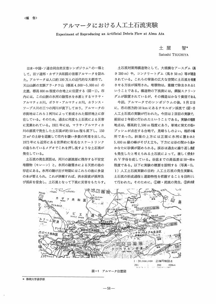
20 0 0 0 OA アルマータにおける人工土石流実験
- 著者
- 土屋 智
- 出版者
- 公益社団法人 砂防学会
- 雑誌
- 砂防学会誌 (ISSN:02868385)
- 巻号頁・発行日
- vol.46, no.1, pp.58-59, 1993-05-15 (Released:2010-08-06)
- 参考文献数
- 2
12 0 0 0 OA 雲仙普賢岳噴火災害における航空緑化工の施工事例と 早期樹林化に向けた取り組みについて
- 著者
- 山崎 恭介 高橋 祐一
- 出版者
- 公益社団法人 砂防学会
- 雑誌
- 砂防学会誌 (ISSN:02868385)
- 巻号頁・発行日
- vol.68, no.1, pp.78-82, 2015-05-15 (Released:2017-03-21)
- 参考文献数
- 3
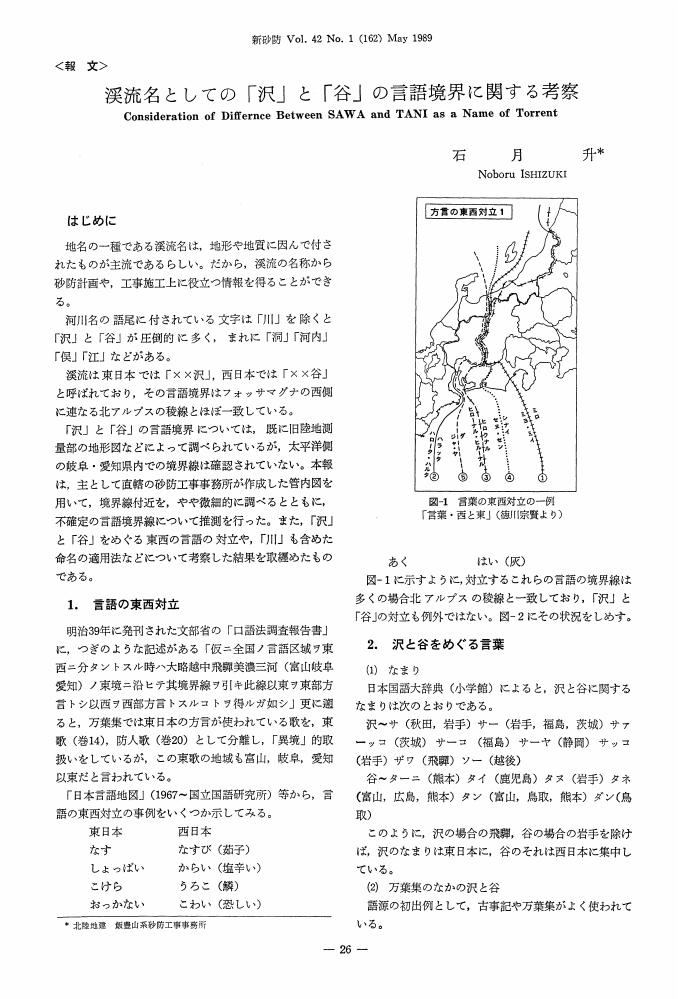
11 0 0 0 OA 渓流名としての「沢」と「谷」の言語境界に関する考察
- 著者
- 石月 升
- 出版者
- 公益社団法人 砂防学会
- 雑誌
- 砂防学会誌 (ISSN:02868385)
- 巻号頁・発行日
- vol.42, no.1, pp.26-33, 1989-05-25 (Released:2010-04-30)
- 参考文献数
- 11
9 0 0 0 OA 融雪型火山泥流の発生プロセスに関する実験的研究
- 著者
- 伊藤 英之 吉田 真理夫 長山 孝彦 脇山 勘治 原田 憲邦 南里 智之
- 出版者
- 公益社団法人 砂防学会
- 雑誌
- 砂防学会誌 (ISSN:02868385)
- 巻号頁・発行日
- vol.65, no.1, pp.47-53, 2012-05-15 (Released:2015-08-03)
- 参考文献数
- 18
- 被引用文献数
- 3
Snowmelt-type mudflow is often observed when a pyroclastic flow, surge, blast or a hot-debris avalanche moves over a snow-covered slope. We constructed the experimental equipment to simulate snowmelt due to high-temperature rock fragments moving over a snow-covered channel. The experiments were carried out for nine different cases, changing the parameters of temperature, rock particle diameter, and snow density. On comparing the hydrographs of these nine cases, we found that the following conditions lead to rapid snowmelt and large peak flow : (1) the temperature of the pyroclastic material is sufficiently high ; (2) the snow density is remarkably high, as in the case of solid ice ; and (3) snow is saturated with liquid water, as in the case of slush. The results indicate that the volume of the snowmelt-type mudflow particularly depends on the snow density and the temperature of the pyroclastic materials.
8 0 0 0 OA 平成3年9月伊豆半島南部災害
- 著者
- 棚田 博人 高井 利和 本橋 和志
- 出版者
- 公益社団法人 砂防学会
- 雑誌
- 砂防学会誌 (ISSN:02868385)
- 巻号頁・発行日
- vol.51, no.3, pp.73-76_2, 1998-09-15 (Released:2010-04-30)
- 参考文献数
- 4
7 0 0 0 OA 1792年の島原四月朔地震と島原大変後の地形変化
- 著者
- 井上 公夫
- 出版者
- 公益社団法人 砂防学会
- 雑誌
- 砂防学会誌 (ISSN:02868385)
- 巻号頁・発行日
- vol.52, no.4, pp.45-54, 1999-11-15 (Released:2010-04-30)
- 参考文献数
- 25
Shimabara-Shigatusaku Earthquake occurred on 21 May 1792 (1 April, the 4th year of Kansei, Lunar calender of Japan) in the Unzen volcanic area in western Kyushu, during the last stage of volcanic activity of Mt. Fugen in the period between the end of 1791 and the beginning of 1792. A gigantic landslide was induced by the earthquake on the eastern slope of the Mayu-Yams lava dome of the Unzen volcanic area. Huge amount of soil and rocks rushed into the Ariake Bay generating a big tsunami. The tsunami hit both sides of the bay, and claimed the lives of approximately 15, 000 persons. This is the worst disaster in the history of volcanic hazards in Japan, called as “the Shimabara Catastrophe”.Two old maps concerning the Shimabara Catastrophe prepared in the Tokugawa Era were discovered. One is a predisaster map titled as “Daisin-zu in Kansei 4”, as shown in Fig. 3 and the other one is a post-disaster map titled as “Big map of the Shimabara Catastrophe”, as shown in Fig. 4. Fig. 3 was prepared after flow down of the Shinyake lava flow occurred 25 March-21 April and another earthquake lasted for 2 days period of 21-22 April. Fig. 4 was prepared after Shimabara-Shigatusaku Earthquake and the Shimabara Catastrophe on 21 May.It is supposed that these two maps were drawn exactly from the same place in the Shimabara Castle area. Fig. 5 is bird's-eye view of Mt. Mayu-Yama from the Shimabara Castle based on Digital National Land Information 1996. Photo. 1 is a picture of Mt. Mayu-Yama taken from the Shimabara Castle. These maps and photo show almost same objects in different times.In the center of the post-disaster map as shown in Fig. 4, approximately 50 hummocky debris mounds are shown and on the left hand side which is southern part of the debris mounds, debris flow is depicted. Thus, the map shows that Mayu-Yama was broken down by two different forms of collapse, which caused the debris mounds and the debris flows. According to the map, the author assumes that these movements might not occurre at the same time.
5 0 0 0 OA “鉄砲水”の成立過程と類似現象との関係について
- 著者
- 西本 晴男 松田 如水
- 出版者
- 公益社団法人 砂防学会
- 雑誌
- 砂防学会誌 (ISSN:02868385)
- 巻号頁・発行日
- vol.62, no.5, pp.12-17, 2010-01-15 (Released:2014-02-01)
- 参考文献数
- 39
Flash floods are floods characterized by a very rapid rise of the water stage and they are known to be frequently generated in mountainous torrents. Many deaths are caused by the flash floods that occur almost every year. In Japan, a flash flood is called “teppou-mizu". The origin of this term is associated with silvicultural technologies for timber floating. For example, “teppou-zeki" is an artificial dam to flush timbers downstream even during mountainous torrents. “Teppou-mizu" is not a scientific term although it has been used as common term. After investigating the past usage of these terms in media such as newspapers and dictionaries, it turned out that “teppou-mizu" is generally recognized as a term referring to a phenomenon which generally differs from a debris flow or flood.
- 著者
- 寺田 秀樹 仲野 公章 浅井 健一 山越 隆雄 金子 正則 石井 靖雄
- 出版者
- 社団法人 砂防学会
- 雑誌
- 砂防学会誌 (ISSN:02868385)
- 巻号頁・発行日
- vol.53, no.3, pp.52-57_2, 2000
An earthquake measuring 6.4 in Magnitude (M) on the Richter scale occurred at 16:02 on July 1, 2000, with an epicenter in the sea near Niijima and Kozushima Islands in the Izu island chain. It was followed by torrential rainfall caused by typhoon No.3 in July 7 and 8, and another earthquake measuring M 6.0 at 3:57 on July 9, with a hypocenter near the previous earthquake. They triggered many slope failures in Kozushima Island. The slope failures damaged some houses, and also produced a large amount of sediments on the beds of many streams.<br>In order to assess the risk of sediment-related disasters, the team of Erosion and Sediment Control Department in Public Works Research Institute has surveyed the state of slope failure deposits and erosion and sediment control facilities. The results of the surveys from July 4 to 6 and July 10 to 11 are as follows. 1) Slope failure sediments on the streambeds increase danger of debris flow disasters, because these streams have few erosion and sediment control facilities, except for Kozusawa. 2) Many slope failures and a few landslides were recognized in the surveyed area. Many of these failures occurred in the area of pyroclastic deposits. 3) The torrential rainfall by typhoon No.3 and the earthquake in July 9 widen the area of slope failure caused by the earthquake in July hand also caused new failures. It suggests that additional rainfall or earthquake will cause new failures and area extention of the failures which already occurred.
5 0 0 0 OA 日本三景「安芸の宮島」工事機材を自衛隊ヘリコプターで輸送
- 著者
- 村井 仁
- 出版者
- 公益社団法人 砂防学会
- 雑誌
- 砂防学会誌 (ISSN:02868385)
- 巻号頁・発行日
- vol.61, no.3, pp.52-57, 2008-09-15 (Released:2013-09-02)
5 0 0 0 OA 広島県旧福山藩の石積砂防堰堤 (砂留) ならびに周辺環境整備方針
- 著者
- 高梨 和行 花房 秀俊
- 出版者
- 公益社団法人 砂防学会
- 雑誌
- 砂防学会誌 (ISSN:02868385)
- 巻号頁・発行日
- vol.48, no.4, pp.25-32, 1995-11-15 (Released:2010-04-30)
- 参考文献数
- 8
There are many Masonry Sabo Dams called Sunadome from ancient times in Fukuyama city, Kannabe town in the eastern Hiroshima prefecture.We have comparatively little rain, but much of debris flows due to geographical features in case of long rain in this district. Before, some of these dams were reported at Journal of Japan Society of Erosion Control Engineering in 1977. Historically and structurally, we enforced investigation again in 1994 including other undiscovered dams for environmental complete equipment and regional promotion.So we can say that Sunadome in Fukuyama Han was constructed from the period Edo for protecting human life against debris flows and floods, and original form of Sabo Dam in Japan.
4 0 0 0 OA 鳶崩れ (飛越地震, 1858) による天然ダムの形成と決壊に伴う土砂移動の実態
- 著者
- 田畑 茂清 水山 高久 井上 公夫 杉山 実
- 出版者
- 公益社団法人 砂防学会
- 雑誌
- 砂防学会誌 (ISSN:02868385)
- 巻号頁・発行日
- vol.53, no.1, pp.59-70, 2000-05-15 (Released:2010-04-30)
- 参考文献数
- 48
Hietu Earthquake of M 7.0-7.1 induced a large landslide so called as Tombi landslide on Mt. Tombi in the up-stream area of the Jouganji River in central Japan, on April 9, 1858. This study examines all the available informationon the Tombi landslide, especially its volume and movement, in order to make the whole aspect as clear as possible.According to old documents, two peaks called as Oh (large)-Tombi and Ko (small)-Tombi collapsed and the land-slide debris dammed up mountain valleys to form two large lakes. The landslide dams then failed on April 23 after 14days, and a mud or debris flow rushed down along the Jouganji valley into the Jouganji fan. A mud or debris flow oc-curred again on June 7 after 59 days. The Tombi landslide scarp is composed of massive andesite lava on granodioritebase, which the uppermost part is fragile, and this geological setting was apparently one of the important causativefactors for the slope failure with the shock of the earthquake. The fades of the landslide debris indicated that a rapiddebris avalanche occurred.The volume of landslide debris was estimated as 1.27×10⁸m3 from the distribution of remaining debris in the valley.The landform of Oh-Tombi and Ko-Tombi before the landslide was supposed referring to old document and drawings.The volume of landslide mass was estimated by comparing the old landform with the present landform. The result ofvolume 1.14×10⁸m3 corresponds well with the estimated volume of depositions.
4 0 0 0 日本三景「安芸の宮島」工事機材を自衛隊ヘリコプターで輸送
- 著者
- 村井 仁
- 出版者
- 公益社団法人 砂防学会
- 雑誌
- 砂防学会誌 (ISSN:02868385)
- 巻号頁・発行日
- vol.61, no.3, pp.52-57, 2008
3 0 0 0 OA 箱根山
- 著者
- 神奈川県土木部砂防課
- 出版者
- 公益社団法人 砂防学会
- 雑誌
- 砂防学会誌 (ISSN:02868385)
- 巻号頁・発行日
- vol.44, no.3, pp.39-42_2, 1991-09-25 (Released:2010-04-30)
- 参考文献数
- 4
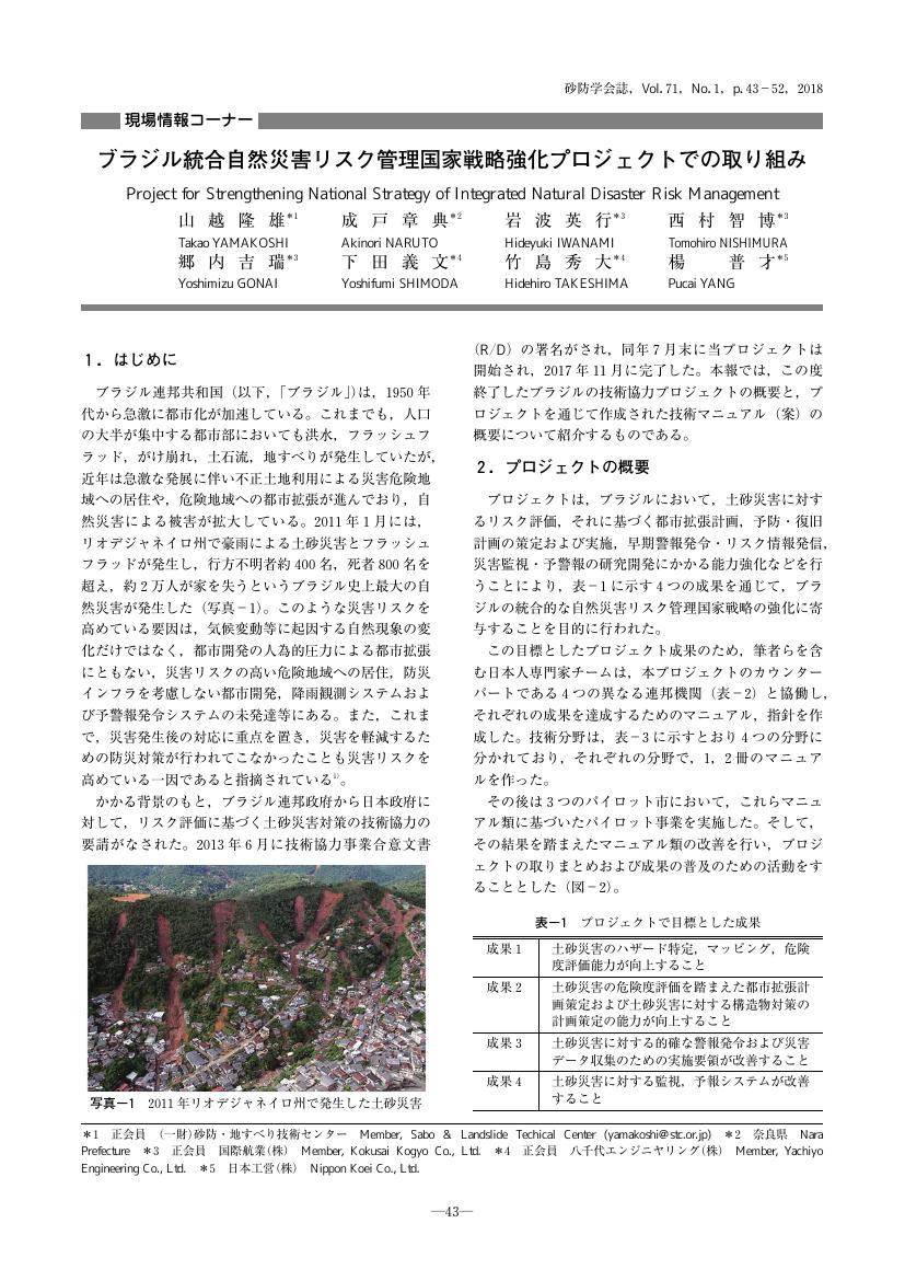
3 0 0 0 OA ブラジル統合自然災害リスク管理国家戦略強化プロジェクトでの取り組み
3 0 0 0 OA ギリシャにおける山地荒廃と土壌の受食性について
- 著者
- 村井 宏 井上 克弘
- 出版者
- 公益社団法人 砂防学会
- 雑誌
- 砂防学会誌 (ISSN:02868385)
- 巻号頁・発行日
- vol.38, no.5, pp.4-11, 1986-01-20 (Released:2010-04-30)
- 参考文献数
- 16
At present, there are many devastated mountains in Greece. Soil loss from this area is a serious problem in terms of national land safeguard. Under such a condition, dams are being established in some places in order to meet the increasing demand of water and to control flood. However, it is pointed out that there is a dangerous possibility that the dams may be stuck with much eroded soil running from upper part of stream. We, together with cooperating researches of Aristoteles University and Ministry of Agriculture Forest Research Insitute in Greece, are continuing our study so as to clarify the causes of mountain devastation and establish the measures for devastation prevention. In 1984, we started our research with the help of Japan Society for Promotion of Science and plan to finish it within two or three years.This report is based on the first field survey held in Oct. 1984 and is a summary of overall view of devastated mountain and results of measurement on infiltration capacity and analyzing of some soil erodibilities in ten survey areas. In each survey area of different cover condition, infiltration capacity was measured by the simple inf iltrometer of tube type and soil . hardness by Yamanka's penetrometer under the naturally undisturbed condition. We analyzed some other erodibilities such as erosion ratio and dispersion ratio of the sampling soils in 0-5cm depth. These erodibility indexes are higher especially on bare land where goats are trampling and in man-made pine forest (Pinus halepensis Miller etc.) than in naturaloak (Quercus: pubescens Willd etc.) and fir (Abies cephalonica Loundon etc.).In the survey of this time. we could not clarify the followings; relation to causes and effects of mountain devastation phenomenon, confirmation of changing process on devastation condition and grasping of exact sediment yield from denuded area. Therefore, we are planning to survey these three points neyt time.
3 0 0 0 OA 平成2年9月奄美大島瀬戸内町で発生した土石流災害
- 著者
- 石川 芳治 佐藤 義晴 前原 幸夫
- 出版者
- 公益社団法人 砂防学会
- 雑誌
- 砂防学会誌 (ISSN:02868385)
- 巻号頁・発行日
- vol.43, no.3, pp.53-56_2, 1990-09-25 (Released:2010-04-30)
- 参考文献数
- 1
3 0 0 0 OA セメントによる水質変化と魚に及ぼす影響の基礎的研究
- 著者
- 船越 和也 上杉 大輔 江口 真由美 小川 恒一 水山 高久 黒川 興及 酒井 敦章
- 出版者
- 公益社団法人 砂防学会
- 雑誌
- 砂防学会誌 (ISSN:02868385)
- 巻号頁・発行日
- vol.55, no.3, pp.43-49, 2002-09-15 (Released:2010-04-30)
- 参考文献数
- 9
The influence of cement in concrete on water quality and fish was studied experimentally. In the summer of 2001, an accident occurred where fish died in a torrent. It was said that the accident was caused by fresh concrete used for sabo structures partly running out into the torrent. That kind of accident has, however, not been reported to date in the field of sabo works. Mortar test pieces were used to study the influence of cement on water and fish in the experiments. The mortar test pieces raised the pH of water up to 11.54 at maximum. When cement was mixed into water directly, the pH of the water went up rapidly even if the quantity of the mixed cement was little, resulting in damage to the Japanese goldfish used in the test. A number of Japanese goldfish died when the pH of water exceeded 10.80. Air entraining agents do not affect the pH of water. Since there is a fear of cement greatly affecting the quality of water and the lives of fish, when concreting sabo structures, it is necessary to take great care to avoid fresh concrete running into the water and increasing its pH to the point of killing fish.
2 0 0 0 OA ハゲ山モデル 小起伏山地における森林と表土の荒廃・回復過程の分析
- 著者
- 塚本 良則
- 出版者
- 公益社団法人 砂防学会
- 雑誌
- 砂防学会誌 (ISSN:02868385)
- 巻号頁・発行日
- vol.54, no.5, pp.66-77, 2002-01-15 (Released:2010-04-30)
- 参考文献数
- 40
- 被引用文献数
- 4
A conceptual process model is presented to analyse the whole process of devastation, denudation and recovery of forests and soils on low relief mountains. The model is composed of the four zones which represent a respective erosion type. The four zones are as follows : The mature forest zone where deep landslides ocurring as natural phenomena are predominant ; The preparatory zone of the active erosion front where shallow landslides are accerelated by forest deterioation and cutting ; The active erosion front zone where most sivere surface erosion and soil slides occur simultainiously ; The bareland zone where the surface soil is denudeted. The model clearif ed the spatial and the temporal process of devastation of forests and denudation of soils, and the importance of accerelation of soil slides by forest cuting in sediment disasters during the past half century.


