1 0 0 0 OA ソコト帝國の滅亡
- 出版者
- 公益社団法人 東京地学協会
- 雑誌
- 地学雑誌 (ISSN:0022135X)
- 巻号頁・発行日
- vol.16, no.4, pp.278-279, 1904-04-15 (Released:2010-12-22)
1 0 0 0 OA 中国山地西南部,山口県伊陸盆地周辺の水系変化と断層運動
- 著者
- 山内 一彦 白石 健一郎 檀原 徹
- 出版者
- 公益社団法人 東京地学協会
- 雑誌
- 地学雑誌 (ISSN:0022135X)
- 巻号頁・発行日
- vol.123, no.5, pp.643-670, 2014-10-25 (Released:2014-11-13)
- 参考文献数
- 50
This paper examines changes to the river system and faulting in the Ikachi Basin and surrounding area in the southwestern part of the Chugoku Mountains since the Middle Pleistocene, based of an investigation of the fluvial terrace and tectonic landforms. Fluvial terrace surfaces in the study area are classified into five levels: H, M1, M2, L1, and L2, in descending order. The M1 terrace surface is widely observed in the Ikachi Basin, and there is a narrow band of Sanbe-Kisuki tephra on the top layer of the terrace deposit, suggesting that the surface was formed around 110-115 ka. Aira-Tn tephra is observed in the L2 terrace deposit, indicating that it was formed around 30 ka. The distribution of terrace and deposit indicates the existence of the Paleo-Shiwari River, which differed from the river system existing today. The Paleo-Shiwari River flowed northwestward from the southeastern margin of the Ikachi Basin, and from near Hizumi, westward through the basin. There is a possibility that the upper reaches of the Paleo-Shiwari River reached Yashiro Island. The Paleo-Shiwari River lost its upper reaches as a result of river capture around the current Obatake-Seto in Middle Pleistocene. Furthermore, as a result of continued large-scale uplifting in the downstream area of the Paleo-Shiwari River basin, accompanied by activities of the Hizumi and Oguni faults since the Middle Pleistocene, the height of the riverbed of the Paleo-Shiwari River increased and its riverbed slope became gentle. At the same time, continued large-scale subsidence with faulting from the downstream basin of the Yuu River to Aki-Nada led to a gradual steepening of the riverbed of the Yuu River, and the valley head of the Yuu River along the fracture zone expanded due to erosion. Subsequently, the Paleo-Shiwari River was captured by the Yuu River at the Hizumi depression around 110-115 ka during the formation period of the M1 surface. It is concluded that river capture between the Yuu River and the Shiwari River occurred due to the influence of crustal movements.
1 0 0 0 OA アフリカの地理学 ―地理学における新しいパートナーシップの確立にむけて―
- 著者
- 大山 修一 桐越 仁美
- 出版者
- 公益社団法人 東京地学協会
- 雑誌
- 地学雑誌 (ISSN:0022135X)
- 巻号頁・発行日
- vol.121, no.5, pp.913-927, 2012-10-25 (Released:2012-12-05)
- 参考文献数
- 67
This paper describes the academic themes, lessons and social problems geographers are addressing in modern Africa, as well as university geography education and the education levels in Sub-Sahara Africa, related to colonial policy, socio-economic stability, and population. Nature, culture, and society in Africa are both diverse and attractive to academic researchers. According to one estimate, there are more than 1,000 languages and ethnic-groups on the continent. We hope to research the uniqueness of nature, cultures, and societies of Africa. African people face social problems of poverty, economic disparity, social conflict, civil war, diseases, land degradation, etc. Japanese geographers should tackle these problems with African researchers in order to contribute to political stability, social welfare and development. South Africa is the most active country engaging in geographical research and education in Sub-Sahara Africa. According to the history of South African academe, the South African Geographical Society and the Society for Geography were integrated in 1994 to establish the Society of South African Geographers. South African geographers considered this movement to be a historical event under political changes that emerged during the new era following the policy of apartheid. Geographers are tackling social problems of Sub-Sahara Africa and social responsibility is important for academic researchers in Africa. Japanese geographers need to build stronger and wider partnerships with African geographers to achieve further social responsibility.
1 0 0 0 OA オーストラリアの地理学
- 著者
- 堤 純
- 出版者
- 公益社団法人 東京地学協会
- 雑誌
- 地学雑誌 (ISSN:0022135X)
- 巻号頁・発行日
- vol.121, no.5, pp.891-901, 2012-10-25 (Released:2012-12-05)
- 参考文献数
- 7
This paper presents an overview of geography in Australia. It answers three main questions. Does the teaching of geography in Australia focus on specific topics? How is geography taught in secondary schools? And, what differences are there in the approaches taken to geography in Australia and Japan. In Australia, geography is first taught in year five at primary school level. The teaching of geography aims to provide background knowledge that is essential to understand both natural and human elements of the world and how they interrelate. This enables students to better understand the impacts of human beings on natural environments. The teaching of geography in Australia is more advanced than it is in Japan. According to the website of the Institute of Australian Geographers, geography is taught at 18 of 41 universities in Australia. At these universities, geography programs are supported by a wide range of resources and include specialized research groups such as physical geography, GIS, remote sensing, and human geography. Some Australian universities have recently reformed their teaching systems. In this process, geography departments were merged with those of other disciplines, which resulted in a decline in the number of geographers. However, based on the above, geography is widely accepted as an academic subject in Australia.
1 0 0 0 OA ブラジルにおける地理学の発展と日伯学術交流の歩み
- 著者
- 丸山 浩明
- 出版者
- 公益社団法人 東京地学協会
- 雑誌
- 地学雑誌 (ISSN:0022135X)
- 巻号頁・発行日
- vol.121, no.5, pp.799-814, 2012-10-25 (Released:2012-12-05)
- 参考文献数
- 55
This paper begins with a review of the progress of scientific geography in Brazil, and proceeds to explain academic exchanges between Japan and Brazil. The results are summarized as follows: (1) Geography in Brazil made great breakthroughs in the 1930's by actively absorbing scientific geography from Western nations, especially from France. (2) The notable progress in Brazilian geography owes much to the contributions of academic societies established in the 1930's, i.e., Institute Brasileiro de Geografia e Estatística (IBGE), Conselho Nacional de Geografia (CNG), Associação dos Geógrafos Brasileiros (AGB), and several leading universities. (3) Academic exchanges between Japan and Brazil in the field of geography started after World War II, when Japan resumed diplomatic relations with Brazil. The main subject of early research by Japanese geographers was the adaptation and settlement process of Japanese immigrants in Brazil. (4) From 1966, overseas scientific research expeditions by members of Tokyo University of Education and the current University of Tsukuba were conducted under Grant-in-Aid for scientific research. (5) Brazil has achieved great economic growth as a member of the BRICs. Social and environmental problems caused by rapid agricultural and fuel development have been the main subjects of Brazilian studies.
1 0 0 0 OA インドネシアの地理学 ―大学教育にみるその特徴―
- 著者
- 瀬川 真平
- 出版者
- 公益社団法人 東京地学協会
- 雑誌
- 地学雑誌 (ISSN:0022135X)
- 巻号頁・発行日
- vol.121, no.5, pp.867-873, 2012-10-25 (Released:2012-12-05)
- 参考文献数
- 3
This paper presents an overview of the current status of geography in Indonesia with particular reference to the university education system. Geography as a discipline apparently occupies a peripheral position in the academic institutions of Indonesia as shown by the fact that so far only three universities offer geography-majors among the nation's some four-hundred colleges. The geography of Indonesia today is characterized by three major trends. The first is a preference for physical geography in accordance with the perception that geography as a whole is one of the natural sciences. The second trend can be observed in the remarkable emphasis placed upon new technologies applying spatial information, which are both subject of study and advanced tools. Finally, geography seeks to play an active role as a practical science within the context of a nation addressing development and integration.
1 0 0 0 OA インドにおける地理学の発展と課題
- 著者
- 岡橋 秀典 南 埜猛 澤 宗則 スッバイヤー S.P.
- 出版者
- 公益社団法人 東京地学協会
- 雑誌
- 地学雑誌 (ISSN:0022135X)
- 巻号頁・発行日
- vol.121, no.5, pp.874-890, 2012-10-25 (Released:2012-12-05)
- 参考文献数
- 11
- 被引用文献数
- 1 1
This paper examines the present status of geography in India and problems based on trends in modern history, geography education and research. Geography has developed remarkably in higher education since the country won independence from Great Britain. Large numbers of universities and colleges have been established since the 1960s, and departments of geography have also opened rapidly with a spatial bias towards the North India Region. In 1992, 66 university departments in the country taught geography and undertook research. Human geography receives more emphasis than physical geography. In the former, agricultural geography and urban geography were the most active fields of the research. Regional planning has also occupied the interests of geographers under the country’s planned economy. In recent years, the technologies using computers such as GIS and remote sensing have been introduced into the discipline, and have driven development in geography departments. However, various problems are pointed out in the present status of geography. There are questions about innovation in geographical theory, methodology and education.
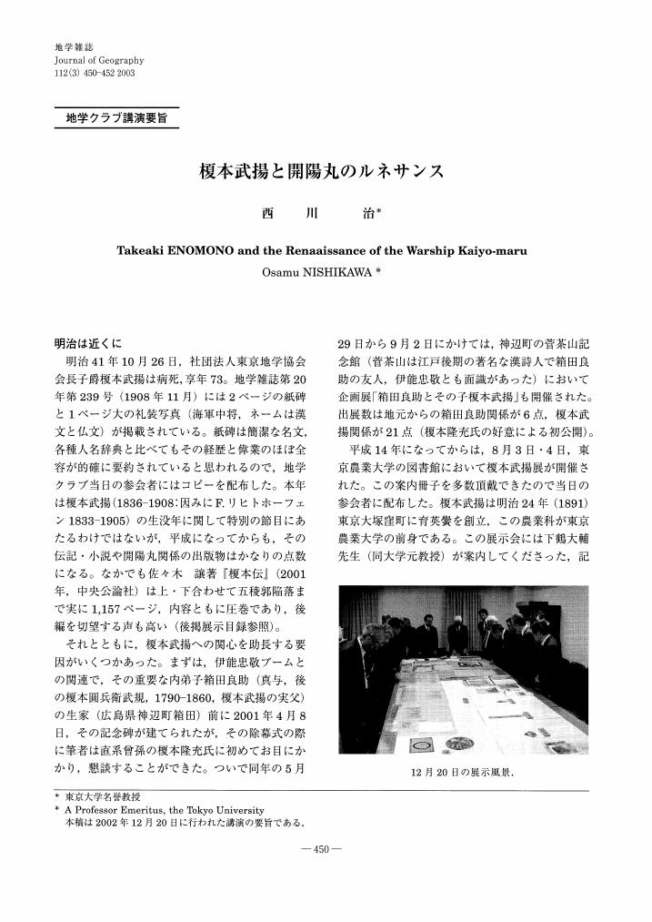
1 0 0 0 OA 榎本武揚と開陽丸のルネサンス
- 著者
- 西川 治
- 出版者
- Tokyo Geographical Society
- 雑誌
- 地学雑誌 (ISSN:0022135X)
- 巻号頁・発行日
- vol.112, no.3, pp.450-452, 2003-06-25 (Released:2009-11-12)
1 0 0 0 OA 周防國小瀬河の魚切岩竝に蛇喰岩
- 出版者
- 公益社団法人 東京地学協会
- 雑誌
- 地学雑誌 (ISSN:0022135X)
- 巻号頁・発行日
- vol.5, no.3, pp.139-140, 1893-03-25 (Released:2010-12-22)
1 0 0 0 OA 伊能忠敬特集号の編集にあたって
- 著者
- 星埜 由尚
- 出版者
- 公益社団法人 東京地学協会
- 雑誌
- 地学雑誌 (ISSN:0022135X)
- 巻号頁・発行日
- vol.129, no.2, pp.155-160, 2020-04-25 (Released:2020-05-12)
- 参考文献数
- 22
- 被引用文献数
- 3
1 0 0 0 OA 日本人の富士山観の変遷と現代の富士山観
- 著者
- 田中 絵里子 畠山 輝雄
- 出版者
- 公益社団法人 東京地学協会
- 雑誌
- 地学雑誌 (ISSN:0022135X)
- 巻号頁・発行日
- vol.124, no.6, pp.953-963, 2015-12-25 (Released:2016-01-27)
- 参考文献数
- 26
- 被引用文献数
- 2 2
This study clarifies contemporary perceptions of Mount Fuji on the basis of the sensibilities of the Japanese people, who are influenced greatly by subjective and sentimental ways of viewing landscapes. Over the course of history, the way in which the Japanese have perceived Mount Fuji has changed due to experiences in each successive era, whether these have been natural disasters that accompanied eruptions, the shifting vista of Mount Fuji as seen from moving political capitals, or the development of mountain-climbing routes; in other words, reflecting of subjective factors such as individuals' perceptions of nature and culture within the context of such experiences. This study is a quantitative analysis based on a questionnaire survey of contemporary Japanese perceptions of Mount Fuji following its registration on the UNESCO World Heritage List. From the results of the analysis, when considering the way Mount Fuji is perceived from the Japanese sense of landscape, a comparison with ways Mount Fuji was perceived in the past indicates the following: while some aspects of contemporary perception of Mount Fuji have been inherited from a past that reflects underlying Japanese views of nature and culture, there are also newer aspects that have originated from a more recent overall national experience of the movement for World Heritage registration and the social background revealed in media coverage following registration. However, no significant differences are found as to whether individual respondents' had ever climbed to the summit or lived in a region where Mount Fuji is visible. This appears to be a result of increased exposure to various of information on Mount Fuji in the mass media, which have provided supplementary information to citizens living far away or who have no personal experience of Mount Fuji. This can be said to have formed a unified national view of Mount Fuji.
1 0 0 0 OA 測地学75年
- 著者
- 宮部 直巳
- 出版者
- 公益社団法人 東京地学協会
- 雑誌
- 地学雑誌 (ISSN:0022135X)
- 巻号頁・発行日
- vol.63, no.3, pp.122-126, 1954-09-30 (Released:2009-11-12)
- 参考文献数
- 1
1 0 0 0 OA 在日米軍横田基地所在地域における軍用機騒音問題
- 著者
- 新井 智一
- 出版者
- Tokyo Geographical Society
- 雑誌
- 地学雑誌 (ISSN:0022135X)
- 巻号頁・発行日
- vol.116, no.2, pp.275-286, 2007-04-25 (Released:2009-11-12)
- 参考文献数
- 18
- 被引用文献数
- 2 2
In Japan, several American air force bases have raised the problem of aircraft noise pollution. This paper considers how municipalities around American air force bases have dealt with this problem. The study clarifies the relationship between aircraft noise pollution and compensation received in the municipalities around Yokota Air Force Base, an American air force base located near Tokyo, and the political actions taken by the municipalities against such pollution.Yokota Air Force Base was established in 1945. The functions of this base had expanded by the 1960s, so aircraft noise pollution intensified. Only Akishima City Council adopted many resolutions against aircraft noise. Aircraft noise pollution was not eliminated. Some inhabitants of Akishima City went to court to require the United States of America not to fly at night.The aircraft noise pollution intensified in Akishima City and Mizuho Town, which are located in the area where the runway of the base was extended. The national government has granted the municipalities subsidies as compensation for aircraft noise pollution. Fussa City, Musashi-Murayama City, and Mizuho Town have received large national subsidies. These municipalities did not adopt many resolutions against aircraft noise.The national government has increased the subsidies since 1974 in exchange for the consolidation of American air force bases in the Kanto Region into Yokota Air Force Base. The public finances of Akishima City have depended on subsidies because of urbanization.The compensation provided by the national government has been based on territoriality, although the pollution is unterritoriality. The political actions of the municipalities around the base have been segmented so aircraft noise pollution has not been eliminated.
1 0 0 0 OA 入植農家からみた干拓地農業の変容過程
- 著者
- 山野 明男
- 出版者
- Tokyo Geographical Society
- 雑誌
- 地学雑誌 (ISSN:0022135X)
- 巻号頁・発行日
- vol.107, no.1, pp.25-48, 1998-02-25 (Released:2009-11-12)
- 参考文献数
- 26
- 被引用文献数
- 1
This research examines the changing process of farming on reclaimed land, as seen from the changing farming conditions of each settler, in the context of national land reclamation, which took place after the Second World War when agricultural production was increasing.As a case study, I researched the background of 136 settlers who started farming in 1962 on Nabeta Reclaimed Land, Aichi Prefecture, situated at the mouth of Kiso River. I examined the following 3 points : (1) settlement conditions of Nabeta Reclaimed Land, (2) the influence of Typhoon hazards from Ise Bay on the farming behavior of settlers and (3) the influence of urbanization from the metropolitan area Nagoya. The results are as follows : 1) There occurred some differences in farming among settlers, depending upon the time of settlement, their native places, the land condition of their farm and their successors. The difference in farming was most greatly influenced by land conditions based on the time of settlement.2) The changing process of farming in Nabeta Reclaimed Land can be divided into 3 periods : 1 st period (commencement of farming), 2nd period (change in farming) and 3 rd period (settlement of farming).3) The farming conditions of settlers diversified gradually over 3 periods : 1 st period→2 nd period→ 3 rd period (Fig. 11). In the 1 st period, conditions were classified into thetype, mainly composed of field husbandry and animal husbandry. In the 3rd period, conditions could be classified into 4 patterns : field husbandry, animal husbandry, part-time farming and abandonment of farming. These were farming patterns that had been already started during the 2 nd period.4) In comparison with other reclaimed lands in Japan, the following can be considered as regional characteristics of Nabeta Reclaimed Land.First, about 20 percent of all settlers were close relatives of those people who were killed by Typhoon Ise Bay. They were less interested in farming, compared to normal settlers, and quite a few of them gave up farming when farming became diversified.Second, about 10 percent of cultivated land (an area of 302 ha) in Nabeta Reclaimed Land turned out to be owned by residents in Nagoya City. Further, settlers have been unable to make the most of accessibility to big markets, because of the lack of community integration in reclaimed land villages and because of the poor performance of specializing in one farm product.
1 0 0 0 OA 断層帯と断層レオロジーの進化
- 著者
- 大橋 聖和 竹下 徹 平内 健一
- 出版者
- 公益社団法人 東京地学協会
- 雑誌
- 地学雑誌 (ISSN:0022135X)
- 巻号頁・発行日
- vol.129, no.4, pp.473-489, 2020-08-25 (Released:2020-10-02)
- 参考文献数
- 108
- 被引用文献数
- 2 4
Knowledge of the strength of faults in the continental upper crust is critical to our understanding of crustal stress states, coseismic faulting, and lithospheric deformation. In this paper, we investigate time- and displacement-dependent fault-zone weakening (softening) over geological time caused by the hydrothermal alteration of rock, the development of faulting-related structure and fabric, and changes in the relevant deformation mechanisms. In the shallow portion of the continental seismogenic zone (< 5 km), hydrothermal alteration induced by comminution and fluid flow along fault zones progressively enriches weak phyllosilicates. The development of phyllosilicate-aligned fabric with increasing shear strain leads to an effective weakening with increasing cumulative fault displacement. In the deep portion of the seismogenic zone (> 5 km), frictional–viscous flow occurs in combination with friction contributed by phyllosilicates and the dissolution–precipitation of clasts after the introduction of water, phyllosilicates and anastomosing fabrics all increasing with greater fault displacement. In addition, the water weakening of quartz and feldspar is an important softening process in the deeper portion of the seismogenic zone (> 10 km). The smoothing of fault-zone topography by the shearing of irregularities and asperities, as well as the thickening of the fault zone, leads to a reduction over time in the bulk frictional resistance of a fault as displacement increases. These time- and displacement-dependent weakening processes of fault zones give rise to diverse strength and stress states of the crust depending on its maturity and may provide clues to reconciling the stress–heat flow paradox of crustal faults.
1 0 0 0 OA 本邦鐵道の快速度蓮韓
- 著者
- 源
- 出版者
- 公益社団法人 東京地学協会
- 雑誌
- 地学雑誌 (ISSN:0022135X)
- 巻号頁・発行日
- vol.44, no.1, pp.50b-52, 1932-01-15 (Released:2010-12-22)
1 0 0 0 OA 我孫子市の液状化被害とそれを教訓としたハザードマップの改訂
- 著者
- 宇根 寛 青山 雅史 小山 拓志 長谷川 智則
- 出版者
- 公益社団法人 東京地学協会
- 雑誌
- 地学雑誌 (ISSN:0022135X)
- 巻号頁・発行日
- vol.124, no.2, pp.287-296, 2015-04-25 (Released:2015-05-14)
- 参考文献数
- 20
- 被引用文献数
- 5 6
The 2011 off the Pacific coast of Tohoku Earthquake brought severe damage caused by wide-ranging soil liquefaction across the Tohoku and Kanto districts. In Abiko City, Chiba Prefecture, heavy liquefaction damage occurred in a small area, which was not accurately predicted by the existing liquefaction hazard map. The authors consider the reason to be land history, such as landform development and artificial landfill, which was not taken into account in the assessment of liquefaction risk. Accordingly, Abiko City has revised the hazard map to take account of micro-landform classifications using land condition maps, old edition maps, and aerial photographs with the assistance of the Geospatial Information Authority's support team.
1 0 0 0 OA 理科大學簡易講習科卒業式
- 出版者
- 公益社団法人 東京地学協会
- 雑誌
- 地学雑誌 (ISSN:0022135X)
- 巻号頁・発行日
- vol.3, no.7, pp.386-387, 1891-07-25 (Released:2010-12-22)
1 0 0 0 OA アイソスタシーに就て
- 著者
- 寺田 寅彦
- 出版者
- 公益社団法人 東京地学協会
- 雑誌
- 地学雑誌 (ISSN:0022135X)
- 巻号頁・発行日
- vol.27, no.6, pp.471-479, 1915-06-20 (Released:2010-10-13)
1 0 0 0 OA 伊能図の意義と特色
- 著者
- 保柳 睦美
- 出版者
- Tokyo Geographical Society
- 雑誌
- 地学雑誌 (ISSN:0022135X)
- 巻号頁・発行日
- vol.77, no.4, pp.193-222, 1968-08-25 (Released:2009-11-12)
- 被引用文献数
- 2 4
The name of Tadataka INÔ (1745-1818), who carried out the survey of the almost entire islands of Japan and made excellent maps of Japan in the end of Edo period, became popular all over the country since the Tokyo Geographical Society erected a bronze memorial monument in the Shiba Park, Tokyo in 1889, which was re-established in the same site with a newly designed beautiful stone monument in 1965.INÔ's Map officially presented to the Takugawa Government in 1821 compiled after his death by his pupils consisted of those of three scales : large scale (1 : 36, 000, 214 sheets), middle-scale (1 : 216, 000, 8 sheets) and small-scale (1 : 432, 000, 3 sheets). Despite its excellency, they were stored in the Library of the Tokugawa Government, only a few limited number of people were allowed to see them, and INÔ's Map proved its usefulness since the Meiji Restoration. These maps served as the basis and the most important data to meet the urgent needs of accurate maps, charts and statistical figures of the Japanese Islands.However, INÔ's Map has an unfortunate history behind it. After it was handed over from the Tokugawa to the Meiji Government, a fire broke out in part of the Imperial Palace in 1873 and destroyed all the maps. INÔ's descendants presented the preserved copies to the Government and they were kept in the Library of the Tokyo Imperial University, while the fire caused by the Kantô Earthquake in 1923 destroyed the Library. In consequence, the number of INÔ's Map which are extant is very small and fragmental today and yet careful studies of these maps, INÔ's books and documents revealed some points which have never been fully appreciated in his achievements, and the followings are the abstracts of these main points.(1) INO's motive for undertaking the survey of Japan was the determination of the length of one degree of latitude, which he carefully determined as 28.2 ri (110.85 km) with extraordinary accuracy at that time. However, “Map of the Eastern Part of Japan” presented to the Tokuwawa Government in 1804 was so elaborate, so accurate, so detailed and so beautiful and gave even an impression of a work of art that the Government appointed him as an official and ordered him to continue the survey, which he carried out with extraordinary persistence and skill. Fig. 2 shows the distribution of INÔ's routes of survey, which was carefully drawn from the maps of middle-scale and his records and the total distances of surveyed lines amounted to 33, 724 km. In addition he traveled several times between Edo and Kyôto (Tôkaidô) as well as Kyôtô and Shimonoseki (Sanyô-dô), so that the total distances of his travel were more than 40, 000 km, which he accomplished when he was fifty-six to seventy-two years of age.The mapped areas are strictly restricted to those of the actually surveyed and certainly known. Therefore, many parts far distant from the roads and the coast left unmapped because the surveys were not conducted. These are some of evidences of INÔ's scientific mind underlying his map-drawing.(2) The Tokugawa Government's needs to the maps were the accurate drawing of configuration of the coastline of the Japanese Islands as well as the detailed distances of important towns along the Tôkai-dô, the Sanyô-dô, and along the northern part of Kyûshû. INÔ's main aims were the determination of latitudes and, if possible the longitudes, of important towns along the most important zone of Japan at that time, that was along the Tôkai-dô and the Sanyô-dô. INÔ's Map met these needs quite well, following basically what is called the method of traverse with great care, and he also adopted astronomical observations.
