1 0 0 0 OA 荒川中流部における大堤外地と横堤の成立
1 0 0 0 荒川中流部における大堤外地と横堤の成立
- 著者
- 松浦 茂樹
- 出版者
- 水利科学研究所
- 雑誌
- 水利科学 (ISSN:00394858)
- 巻号頁・発行日
- vol.28, no.3, pp.9-27, 1984
1 0 0 0 OA 近世の民間土工専門家・黒鍬
- 著者
- 松浦 茂樹
- 出版者
- 一般社団法人 日本治山治水協会
- 雑誌
- 水利科学 (ISSN:00394858)
- 巻号頁・発行日
- vol.63, no.3, pp.51-72, 2019-08-01 (Released:2020-11-02)
- 参考文献数
- 13
江戸時代,「ヒト」としての「黒鍬」は,幕府職制としての「黒鍬」と,川除普請や新田開発を行った土工のプロとしての「黒鍬」がいた。彼らは直接的には関係がない。天保14年(1843)に行われた印旛沼開削普請で登場した「江戸黒鍬」は,筋骨隆々で全身に刺青が描かれ,その働きは他の人夫と比べ抜群であった。彼らは,隅田川浚渫に従事していたのだろう。江戸時代後期,利根川沿いの各地にも「黒鍬」はいた。彼らは,肉体労働を行うとともに技能者として土工現場を指導していた。一方,出稼ぎの黒鍬集団の地としては尾張知多半島が有名であるが,畿内そして関東にも進出していた。 明治に入ると,鉄道などの社会インフラ整備が進められていったが,大規模工事を担う新たな土工のプロが出現した。職業分類では「土方」と整理されたが,「黒鍬」と「俠客」の中から育っていった。「俠客」は,大勢の人夫をまとめる力をもつ者として参入してきたのである。なお,土を掘削したり運んだり基礎を固める作業を意味する用語「土工」も,earth work を訳したものとして誕生した。
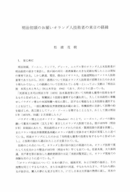
1 0 0 0 OA 明治初頭のお雇いオランダ人技術者の来日の経緯
- 著者
- 松浦 茂樹
- 出版者
- 一般社団法人 日本治山治水協会
- 雑誌
- 水利科学 (ISSN:00394858)
- 巻号頁・発行日
- vol.34, no.3, pp.1-12, 1990-08-01 (Released:2019-08-13)
- 参考文献数
- 12
1 0 0 0 OA <論説>一七二七年の北京会議と清朝のサハリン中・南部進出
- 著者
- 松浦 茂
- 出版者
- 史学研究会 (京都大学文学部内)
- 雑誌
- 史林 = THE SHIRIN or the JOURNAL OF HISTORY (ISSN:03869369)
- 巻号頁・発行日
- vol.86, no.2, pp.176-208, 2003-03-01
個人情報保護のため削除部分あり
1 0 0 0 IR 1727年の北京会議と清朝のサハリン中・南部進出
- 著者
- 松浦 茂
- 出版者
- 史学研究会 (京都大学文学部内)
- 雑誌
- 史林 (ISSN:03869369)
- 巻号頁・発行日
- vol.86, no.2, pp.176-208, 2003-03
個人情報保護のため削除部分あり雍正四年(一七二六) から五年にかけて、清とロシアは北京で国境交渉を行ない、モンゴル地方と並んで、ネルチンスク条約で先送りされたウダ川地方の帰属に関しても、協議を行なった。その際に両国は、それぞれの地図を交換して検討することにし、ロシアは清にホマンの地図帳などを提供した。その中には巨大なカムチャツカ半島が描かれていて、幻の土地エゾはその南端にあると記されていた。清はエゾ問題に関心をもち、エゾの地を探して沿海地方やサハリン北部を調査したこともあったが、サハリン中部以南については、一度も調査を行なったことはなかった。北京会議では結局ウダ川地方の帰属を決定することはできなかったが、清はエゾをロシア領とするロシアの見解に衝撃を受けた。そこで会議の終了直後から、サハリン中・南部とエゾとの関係を明らかにするために、サハリン中・南部の調査を開始し、同年には早くも上京していたアムール川下流のホジホン、ダイジュをサハリン中部の東海岸を派遣した。さらに雍正七年にはシサ国(日本) との関係を解明するために、イランハラの驕騎校イブゲネらを同地方に送ったが、このときイブゲネらは、日本本土製のよろい・刀・漆器などをもち帰っている。それから雍正十年にはイブゲネらを再度サハリンに送り、中・南部のアイヌを始めとする、全部で百四十六戸の住民を従属させた。この結果清の勢力は、サハリンの南端に達して、サハリンのほぼ全島がその勢力下に置かれたのである。In 1690 (the twenty-ninth year of the Kangxi reign) the Qing government dispatched nine investigative parties to the regions on the left bank of the Amur River in order to certify the border with Russia, which had been determined by the Treaty of Nerchinsk the previous year. One of the parties reached the northern part of the Sakhalin. Then, in 1709 (296) and 1711 the Qing again dispatched parties to the Maritime Province and the northern part of Sakhalin in order to create a new map of East Asia, ''she Map of a Comprehensive View of Imperial Territory" 皇輿全覧図. But the parties were unable to investigate the central and southern parts of Sakhalin. In 1726 (the fourth year of Yongzheng reign) and 1727, the Qing and Russian governments entered diplomatic negotiations in Peking concerning the border between the two countries. They discussed the demarcation lines of not only the Mongol district but also the Uda River district, which had not been settled during the negotiations for the Treaty of Nerchinsk. On this occasion the two countries exchanged and examined each other's maps. The Russian ambassador provided the Qing ambassadors Homann's atlas, in which there was depicted an enormous Kamchatka peninsula to which the legendary land of Yezo had been appended in the south. Ultimately, the two countries were unable to decide on the border in the Uda River district at the Peking conference, and the Russian view that Yezo was the territory of Russia caused alarm within the Qing government. Therefore immediately after the conference, the Qing government began to investigate the central and southern parts of Sakhalin in order to clarify the geographical relationship between Sakhalin and Yezo. In 1727 the Qing government sent Daiju, who lived in the lower reaches of the Amur River but happened to have been in Peking, to the eastern coast of central Sakhalin. In 1729 it dispatched bannermen such as Ibgene, a Lieutenant in Ilan hala, to the same district in order to clarify the relationship with Sisa gurun (Japan). They collected and brought back Japanese armor, swords, and lacquer ware. Then in 1732, the Qing again dispatched Ibgene and others to Sakhalin. They subordinated three clans of the Ainu people in the central and southern areas as well as three clans of the Nivkhi people in the northern part of the island, totaling 146 households in all. As a result of these efforts, the Qing advanced to the southern end of the Sakhalin, and obtained control of almost all the island.
1 0 0 0 OA アメリカTVAのダム事業における歴史と現状
- 著者
- 松浦 茂樹
- 出版者
- 一般社団法人 日本治山治水協会
- 雑誌
- 水利科学 (ISSN:00394858)
- 巻号頁・発行日
- vol.40, no.5, pp.52-82, 1996-12-01 (Released:2019-03-31)
- 参考文献数
- 14
1 0 0 0 OA 関宿から利根川東遷を考える
1 0 0 0 OA 戦前の旭川改修と舟運の整備
- 著者
- 佐合 純造 松浦 茂樹
- 出版者
- Japan Society of Civil Engineers
- 雑誌
- 土木史研究 (ISSN:09167293)
- 巻号頁・発行日
- vol.19, pp.127-137, 1999-05-01 (Released:2010-06-15)
- 参考文献数
- 32
The government, which had established a river improvement plan in 1925, started improvement projects in 1930 on the Asahi River. Main purpose of the project was to improve the inland navigation system as well as flood control City planning law was applied to Okayama city in 1923.Since the navigation system of the downstream of the Asahi River was very important for the urban development, it was asserted that the downstream of the Asahi River should be turned into a canal.The Hyakken. River had been diverged from the main stream of the Asahi River in the 1600s.The people of Okayama raised objections to the original plan, and besides, there was the intense struggle with the improvement plan between those who lived in the area near the main stream and those who lived in the area near the diverged channel.Finally, the Hyakken River was officially designated as a diversion channel in the plan, and the main stream of the Asahi River was improved to serve the needs of navigation system as well as a flood flow channel.
1 0 0 0 OA 足尾鉱毒事件と渡良瀬川東遷
- 著者
- 松浦 茂樹
- 出版者
- 一般社団法人 日本治山治水協会
- 雑誌
- 水利科学 (ISSN:00394858)
- 巻号頁・発行日
- vol.47, no.3, pp.31-59, 2003-08-01 (Released:2018-02-23)
- 参考文献数
- 13
1 0 0 0 釜無川左岸連続堤防の築造経緯
扇状地河川の一つ、富士川右支川釜無川の扇頂左岸に築堤されたのが著名な信玄堤である。この信玄堤を原型とする釜無川左岸堤は、明治29年の洪水で建設以来、初めて破堤した。当該水害の問題点などは、既に岩屋が明らかにしているところであるが、この明治29年の時点で、釜無川左岸堤は、既に連続堤防となっていた。では、不連続堤また霞堤の代表格として各種論文等に記載されることが多い釜無川左岸堤は、どのような理由で連続堤防へと変貌したのか。本論は、かかる釜無川左岸堤の連続化の築造経緯を明示することによって、富士川明治改修の特徴を明らかにする。信玄堤の連続化の経緯等は、これまで明らかにされたことが無いから、この点において本論の意義がある。
1 0 0 0 OA 故竹内俊雄先生が語る水文学・流量観測の世界
- 著者
- 松浦 茂樹
- 出版者
- 一般社団法人 日本治山治水協会
- 雑誌
- 水利科学 (ISSN:00394858)
- 巻号頁・発行日
- vol.40, no.3, pp.95-123, 1996-08-01 (Released:2019-03-31)
- 参考文献数
- 2
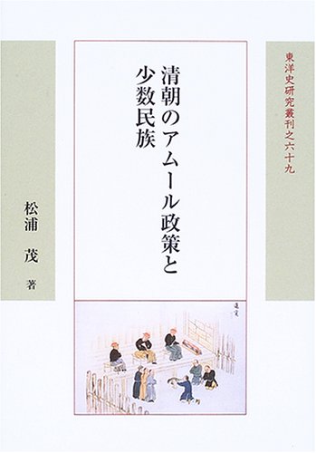
1 0 0 0 清朝のアムール政策と少数民族
1 0 0 0 明治43年大水害と北海道移住:──足尾鉱毒問題との関連を中心に
- 著者
- 松浦 茂樹
- 出版者
- 水利科学研究所
- 雑誌
- 水利科学 (ISSN:00394858)
- 巻号頁・発行日
- vol.58, no.1, pp.143-168, 2014
明治43年(1910)8月,関東地方を中心に東日本で大水害が生じた。この対策として政府は北海道移住を呼びかけた。この呼びかけに,渡良瀬川支川思川下流部に位置する栃木県下都賀郡から66戸210名が応じた。彼らは,44年4月,現在の北海道常呂郡佐呂間町に入植し,その土地を「栃木」と命名して開墾を進めていった。明治時代,水害罹災者が北海道へ移住するのは珍しいことではなかった。明治22年の奈良県十津川災害では,十津川村から約640世帯,約2,600人が移住し,新十津川村を開いたことはよく知られているが,富山県の常願寺川水害,岐阜・愛知県の木曽川水害でも被害者は新天地を求めて移住した。また40年の富士川大水害後も,山梨県から200戸以上の移住者が北海道に向かっている。ところで栃木県下都賀郡は,明治20年頃から35年にかけて足尾銅山から排出された廃鉱(廃棄された銅分を含む土石)によって鉱毒被害が生じた地域であった。また,佐呂間町に移住した66戸の中には10数戸の元谷中村出身者がいた。このため今日,度々,この移住は足尾鉱毒事件と結び付けられて述べられている。たとえば,昭和57年(1982),開拓70周年を記念して「栃木のあゆみ」が栃木開基開校七十周年記念協賛会から刊行されたが,その冒頭に「(栃木集落は)栃木県人の皆様が足尾銅山の鉱毒に追われ,北海の新天地に永住の地を求めて移住されました」と述べている。つまり栃木集落に移住してきた人々を足尾鉱毒の被害者とし,その移住を足尾鉱毒事件の一環としてとらえている。さらに,政府による「強制移住」との主張もある。
1 0 0 0 1689年ネルチンスク会議 : ロ清両国の国境交渉
- 著者
- 松浦 茂
- 出版者
- 東洋史研究会
- 雑誌
- 東洋史研究 (ISSN:03869059)
- 巻号頁・発行日
- vol.76, no.2, pp.372-332, 2017-09
1 0 0 0 N・S・ブキャナンH・S・エリス『経済発展への手引き』
1 0 0 0 古代の宮都の移転と河川--長岡京,平安京への遷都を中心に
- 著者
- 松浦 茂樹
- 出版者
- 水利科学研究所
- 雑誌
- 水利科学 (ISSN:00394858)
- 巻号頁・発行日
- vol.37, no.2, pp.p41-63, 1993-06
1 0 0 0 非球面検査のためのゾーンプレート・コモンパス干渉計
- 著者
- 中島 一敏 谷川 英夫 松浦 茂
- 出版者
- The Optical Society of Japan An Affiliate of Japan Society of Applied Physics
- 雑誌
- 光学 (ISSN:03896625)
- 巻号頁・発行日
- vol.10, no.3, pp.174-183, 1981
A common-path interferometer with a modified zone plate for testing aspheric optical elements is given. The interferometer described here is the generalization of a conventional Fresnel zone plate interferometer developed by Smartt and is suited to test aspheric refracting elements as well as reflecting ones. Formulas to compute modified zone plates, especially for the conic sections of revolution, are presented. Error analysis for the setting of the zone plate is given and the inter ference pattern in the presence of three dimensional displacement of the zone plate is discussed. It is pointed out that one can set the zone plate by making use of the interferogram itself and thus test the performance of the elements easily. Some experimental examples are presented.
1 0 0 0 近代初期の大阪港整備計画と淀川改修計画-上-
- 著者
- 松浦 茂樹
- 出版者
- 水利科学研究所
- 雑誌
- 水利科学 (ISSN:00394858)
- 巻号頁・発行日
- vol.35, no.2, pp.p47-79, 1991-06
1 0 0 0 フランス総合目録
- 著者
- 松浦茂
- 出版者
- 国立国会図書館
- 雑誌
- カレントアウェアネス
- 巻号頁・発行日
- vol.241, 1999-09-20


