35 0 0 0 Severe acute respiratory syndrome corona virus-2(SARS-CoV-2)mRNAワクチン接種を契機として発症した潰瘍性大腸炎に類似する炎症性腸疾患の症例
- 著者
- 高橋 康貴 下平 陽介 吉田 樹 田近 宗彦 髙橋 壮 渡邊 健太 福田 翔 小泉 重仁 松橋 保 飯島 克則
- 出版者
- 一般財団法人 日本消化器病学会
- 雑誌
- 日本消化器病学会雑誌 (ISSN:04466586)
- 巻号頁・発行日
- vol.120, no.4, pp.325-329, 2023-04-10 (Released:2023-04-10)
- 参考文献数
- 15
64歳女性.SARS-CoV-2 mRNAワクチン(3回目)の接種翌日から排便回数増加,血便,腹痛,発熱を認めた.下部消化管内視鏡検査にて全大腸に深掘れ潰瘍を認め,潰瘍性大腸炎と類似する炎症性腸疾患としてステロイド,インフリキシマブを導入し軽快した.mRNAワクチン接種を契機に発症した潰瘍性大腸炎に類似する炎症性腸疾患を経験した.
1 0 0 0 COVID-19緊急事態宣言下における意識・行動の基礎的調査
- 著者
- 田中 皓介 稲垣 具志 岩田 圭佑 大西 正光 神田 佑亮 紀伊 雅敦 栗原 剛 小池 淳司 佐々木 邦明 佐々木 葉 Schmöcker Jan-Dirk 白水 靖郎 泊 尚志 兵藤 哲朗 藤井 聡 藤原 章正 松田 曜子 松永 千晶 松本 浩和 吉田 樹
- 出版者
- 公益社団法人 土木学会
- 雑誌
- 土木学会論文集D3(土木計画学) (ISSN:21856540)
- 巻号頁・発行日
- vol.77, no.2, pp.129-140, 2021 (Released:2021-06-20)
- 参考文献数
- 20
- 被引用文献数
- 2
本稿ではCOVID-19の蔓延および政府からの社会経済活動自粛要請に伴う,人々の意識行動への影響を把握することを目的にWebアンケート調査を行った.その結果,感染・死亡リスクを,現実の数倍~数千倍過大に評価している様子が明らかとなった.また,接触感染対策として効果的な「目鼻口を触らない」の徹底度合いが他の対策に比べて低く,周知活動の問題点を指摘した.さらに,緊急事態宣言に対する65%以上の支持率や,「家にいる」ことについて,「ストレス」を感じる以上に「楽しい」と感じる人が多いこと,行動決定のために参考にするのはキャスターや評論家や政治家よりも「専門家の意見」の影響が大きいことなどが明らかとなった.
1 0 0 0 街路環境の影響を考慮した市街地における駐車場選択モデルの構築
- 著者
- 吉田 樹 竹内 伝史 秋山 哲男
- 出版者
- Japan Society of Civil Engineers
- 雑誌
- 土木計画学研究・論文集 (ISSN:09134034)
- 巻号頁・発行日
- vol.20, pp.581-588, 2003
モータリゼーションの進展にあわせて整備されてきた市街地の駐車場はもはや供給過剰な状態にあり, このことが民間駐車場の自律的な供給を阻害している要因になっている.従って, 今後の駐車場政策は既存の駐車場の有効活用や適正な配置に留意して進めるべきである.本研究では駐車場利用者が目的地まで徒歩でアクセスしていることに着目し, ナゴヤドーム周辺をフィールドにして, 街路環境の影響を考慮した駐車場選択モデルを構築する.構築されたモデルによって, 駐車料金や目的地までの歩行距離といった第一義的な要因に加えて, 駐車場選択に街路環境の諸特性がどう補完しているのかを検討し, 駐車場の有効活用や適正配置の指針を得る.
1 0 0 0 OA 東京を中心とした都市構造と交通計画との関係
- 著者
- 吉田 樹
- 出版者
- 公益社団法人 東京地学協会
- 雑誌
- 地学雑誌 (ISSN:0022135X)
- 巻号頁・発行日
- vol.123, no.2, pp.233-248, 2014-04-25 (Released:2014-05-16)
- 参考文献数
- 20
- 被引用文献数
- 4 4
This paper describes the history of regional and transport planning in the Tokyo Metropolitan Area, and considers the relationship between urban structure and transport planning. The network of major roads in Tokyo has been shaped by revitalization planning since the Great Kanto Earthquake of 1923 and the Pacific War. However, because of financial difficulties, some roads in the urban plan remain incomplete to this day. On the other hand, the Metropolitan Expressway network was planned around 1950, and about 940 thousand vehicles use the expressway every day. The railway companies around Tokyo, notably Japan National Railways, faced problems of overcrowding because the population of the Tokyo Metropolitan Area had increased and suburbs were created during the high economic growth period from the mid-1950s. Japan National Railways and Council for Transport Policy planned construction of new lines and the congestion rate of railways tended to decrease. Urban structure planning of Tokyo Metropolitan aimed to have a multipolar pattern during the tenures of former Tokyo Governors Shun-ichi SUZUKI and Yukio AOSHIMA. However, around a year after taking office, the former Tokyo Governor, Shintaro ISHIHARA, suggested the concept of a “ringed megalopolis,” which is invested in central Tokyo including subcenters for improving international competitiveness. Even with the different strategy for reconstructing an urban structure, road and railway planning has not changed. Transport planning in Tokyo metropolitan area has depended on urban planning that is designed not to interfere with the placement of urban functions, but follows and satisfies demand resulting from suburbanization. However, because an urban structure with a compact city has become more important, urban structure planning is required to be coordinated with transport planning.
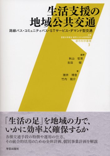
- 著者
- 秋山哲男 吉田樹編著 猪井博登 竹内龍介著
- 出版者
- 学芸出版社
- 巻号頁・発行日
- 2009
1 0 0 0 OA 観光地域における生活者調和型の交通計画スキームに関する研究
本研究は、観光地域における生活者と観光者がともに快適な環境を創出するために、生活者と観光交通の折り合いに配慮した交通計画に関する理論化と計画技術の構築を目的として実施したものである。具体的には、以下の二点について検討した。第一には、青森県奥入瀬渓流地域を事例として、観光地域における交通問題の現象解析とその発生構造の分析を行い、観光バスによる車窓観光が地域の道路交通に与える影響を定量的に示した。第二に、鉄道と自転車の融合利用の一つであるサイクルトレインに着目して、地方鉄道の活性化や観光における周遊手段としての可能性を検討した。
