3 0 0 0 OA 小牧実繁の「日本地政学」とその思想的確立―個人史的側面に注目して―
- 著者
- 柴田 陽一
- 出版者
- 一般社団法人 人文地理学会
- 雑誌
- 人文地理 (ISSN:00187216)
- 巻号頁・発行日
- vol.58, no.1, pp.1-19, 2006 (Released:2018-01-06)
- 参考文献数
- 143
- 被引用文献数
- 2 5
The purpose of this paper is to examine the ideological establishment of the geopolitics of Saneshige Komaki (1898-1990), who was a Professor of Geography at Kyoto Imperial University, and a well-known advocate of “Japanese Geopolitics” during World War 2, and accordingly a remarkable figure in the history of Japanese geography. Approaching this subject biobibliographically, I focus on the personal background of Komaki. Using his own bibliography, and through an analysis of his written works, I trace the development of his thought. To begin with, I demonstrate the ideological background of Komaki’s geopolitics. Komaki had a great antipathy toward Western imperialism. In addition, immigration issues closely related to racial discrimination were his great concern. He held the view that geography in those days had lost its social relevance, and that the nature and culture of each land should be maintained under an indigenous order. Next, I examine the ideological composition of Komaki’s geopolitics. His geopolitics began before the outbreak of the Sino-Japanese War in July 1937. He asserted that “Japanese Geopolitics” was indigenous and one which attaches importance to the autonomy of Japan, after he had criticized the history of Western exploration, conventional geography, and Geopolitik. His geopolitics tried to clarify what was destroyed by Western colonization and had an historico-geographical and irrational character. Lastly, I point out some of the positive and negative aspects of his geopolitics. The social relevance of geography, his criticism of Western colonialism and the issue of positionality in research can be seen the light of Japan at that time. On the other hand, the lack of an attitude to relativize Japan and the subjective/intuitive judgement in the reasoning process were negative aspects. However, the positive and negative are not clearly divided. “Japanese Geopolitics” has suggested important issues in connection with the political nature and the social relevance of geography and geographical knowledge, although it served to justify the aggressive wars of the Japanese Empire.
3 0 0 0 OA 元島民・子孫による北方領土返還運動の形骸化
- 著者
- 中村 尚弘
- 出版者
- 一般社団法人 人文地理学会
- 雑誌
- 人文地理 (ISSN:00187216)
- 巻号頁・発行日
- vol.52, no.5, pp.514-530, 2000-10-28 (Released:2009-04-28)
- 参考文献数
- 73
- 被引用文献数
- 1
Recent geographical studies of national boundaries/territories in English-speaking countries ave devoted considerable attention to the instability of nation-states mainly due to an upsurge in ethnic nationalism. While territorial issues have generally been regarded as a conflict between the nation-state and ethnic nationalism, other territorial issues between nation-states have attracted relatively little attention. The purpose of this paper is to draw attention to the movement for restoring the Northern Territories, which constitutes a longstanding problem between Japan and Russia, as an example of these issues, and to examine its implications for geography.The issue of the Northern Territories, which are located east of Hokkaido and belong to Japan, emerged in 1945 when troops of the former USSR occupied them. The movement for the restoration of the Territories to Japan started immediately due to extreme pressure from former islanders and local people whose economic base lay mainly in long shore fisheries. A few years later, organizations for the movement were formed. Their main purpose was to popularize the recognition that the restoration problem was a national task for all Japanese and to plan a process of diplomatic negotiations with present-day Russia. This implies that the restoration movement required 'nationalism' from the Japanese side.From interviews with those in charge of this movement, however, the following findings were obtained. Although the purpose of the movement is to realize restoration by popularizing the territorial issue among all Japanese citizens, the people concerned with the movement cannot directly be engaged in diplomatic negotiations. A promising indication of a settlement has not yet been found. In recent years, the perpetuation of the movement itself has become its prime purpose.Noticeable in this context is a recent division among people concerned with the movement. On the one hand, former islanders and their descendants know that the problem of the Northern Territories is a national problem, particularly the former islanders, for whom the Territories are home and who have shown great support for the movement. On the other hand, people who were not born or who had not grown up there and are thus only under an obligation to be involved in the movement, have not supported it so strongly. Nowadays, it is rather unusual for former islanders and their descendants to expect to migrate to the Territories even after possible restoration, but they generally think that the movement as a national task should continue. Partly due to the development of local exchange with Russians in the Territories, descendants of the younger generation are not necessarily aware that their restoration is a national issue.As a result, the movement framework based on such awareness seems to have been in process of becoming a mere shell, and solidarity within the organizations concerned has weakened. In the meantime, the intention of the Japanese Ministry of Foreign Affairs concerning this territorial problem is also related to current international relations, and, as a result, the feelings of former islanders are not fully taken into account. Accordingly, the restoration movement is limited in the sense that the Japanese state does not unit with Japanese citizens.
3 0 0 0 日本における宗教地理学の展開
- 著者
- 松井 圭介
- 出版者
- 一般社団法人 人文地理学会
- 雑誌
- 人文地理 (ISSN:00187216)
- 巻号頁・発行日
- vol.45, no.5, pp.515-533, 1993
- 被引用文献数
- 5 3
Geography of religion aims to clarify the relationships between the environment and religious phenomena. In Japan, this discipline has four major fields of research<br>The first field is that of the relationships between the natural environment and religion. The emphasis in this field, however, is on the influence of the environment upon religion. Whereas many scholars study how climate and topography change the formation of religious beliefs, there is almost no study of the influence of religion upon the natural environment. In order to fill this lack, it is necessary, for instance, to clarify the role of religion in environmental protection.<br>Secondly, geographers of religion study how religion influences social structures, organizations, and landscapes in local areas. They mainly examine the urban structure and its transformation within religious cities with regard to the dominant religion. There are also some studies about the significance of religion for the formation of new cities. The relationships of the religious orientation to the local structure of cities and villages, however, has not been thoroughly clarified yet.<br>Thirdly, pilgrimage forms another major field of research in the geography of religion. Most studies so far, however, remain preliminary, showing the routes of pilgrimage without reconstructing networks among sacred places and their surroundings. Moreover, the contemporary meaning of pilgrimage is not studied enough, though people today still carry out pilgrimages fervently.<br>Lastly, geographers of religion try to clarify the structure of space which is created by the sacred, through examining the distribution and propagation of religion. One of the major studies in this field is that of sphere of religion.<br>This geography of religion as the study of relationships between the environment and religion has two indispensable approaches, for the space created through these relationships has two aspects; empirical and symbolic. On the one hand, religion has power to organize local communities and this power generates the structure of space which is grasped empirically. On the other hand, religion supports human existence through offering a cosmology. This cosmology appears in the structure of space symbolically. Geography of religion should understand the religious structure of space throughly by adopting both positivistic and symbolic approaches.
3 0 0 0 「二層の広域圏」の「生活圏域」構想に関する考察と提言
- 著者
- 森川 洋
- 出版者
- 一般社団法人 人文地理学会
- 雑誌
- 人文地理 (ISSN:00187216)
- 巻号頁・発行日
- vol.61, no.2, pp.111-125, 2009
<p>In May 2004 the National Land Council introduced the concept of 'service areas of central cities (living areas)' in the 'regional structure of two tiers'. It consists of two parts: 9 regional blocks with 6 to 10 million inhabitants, and 82 living areas principally with more than 300,000 inhabitants in areas delimited by a one-hour-distance (by family car) from central cities with over approximately 100,000 inhabitants. However, in actually considering their distribution as uniform as possible throughout the whole country, there are smaller areas such as the living area of Imabari City with only 190,000 inhabitants in 82 living areas which are distributed similarly to the 85 commuting and schooling areas prepared by the Ministry of Land, Infrastructure, Transport and Tourism. Within these 82 living areas about 90 percent of total population of the country can enjoy fundamental urban services and maintain their high living condition. Accordingly, the concept of living areas is intended to prevent population decreases in non-metropolitan areas.</p><p>Although this concept that intends to maintain a uniform living standard for the inhabitants of non-metropolitan areas seems to be mostly effective in the period of population decrease forecast for the future, it tends to overestimate the service areas of central cities as compared to the actual commuting area of each central city as shown in Table 3. Commuting areas of smaller cities located on the peripheries of designated living areas, such as the commuting area of Kashiwazaki City near by Nagaoka City and the commuting area of Mihara City near Fukuyama City, are fearful of extraordinary decline under decreasing population brought about by the measures for the promotion of these 82 central cities. In order to prevent the rapid population decrease of central cities and their surrounding areas in non-metropolitan areas, and to keep a population balance between them and metropolitan areas, it is necessary to designate smaller central cities with living areas of 100,000 to 300,000 inhabitants as the second tier, adding to the living areas of over 300,000 inhabitants. In addition, the author will propose the promotion of central places with living areas of more than 10,000 inhabitants as the third order. The promotion measures of larger cities strikes a severe blow to smaller cities, so it is necessary to promote not only large cities but also small cities. Since some of these small central places have under-populated areas within their living areas, these measures will contribute to relieving the population decrease in under-populated areas and areas rich in natural surroundings.</p>
3 0 0 0 OA 集約的農業地域における社会関係からみた農地移動の展開―兵庫県南あわじ市上幡多集落の事例―
- 出版者
- 一般社団法人 人文地理学会
- 雑誌
- 人文地理 (ISSN:00187216)
- 巻号頁・発行日
- vol.64, no.2, pp.103-122, 2012 (Released:2018-01-24)
- 参考文献数
- 33
- 被引用文献数
- 3
This study aims at revealing how farmlands are managed by examining the roles played by the transfer of farmland rights in farm management and agricultural settlements; the study’s analysis is based on the social relationships among farmers that are involved in the process of transferring farmland rights for farmland maintenance. This study focuses on the spread and connection of social relationships among farm households. Past studies have often integrated the ties between farm households with territorial and kinship relations. This study focuses on the spread and connection of social relationships among farm households. This study classifies territorial relations on the basis of spatial spread as well as kin relations by degree of kinship. It also classifies various other social relationships after a careful consideration of each of their characteristics and analyzes them based on how these social relationships form layers, as explanatory variables, and who uses farmlands through the transfer of farmland rights as explained variables.The following area was selected as study area: the Kamihata settlement in Minami Awaji City, Hyogo Prefecture, located on the Mihara Plain of Awaji Island, where even small farms in the settlement show an intensive use of farmland all year around. On the Mihara Plain, the “three crop” rotation system—a combination of paddy rice, onions, and cabbages, or paddy rice, lettuce, or Chinese cabbages—has been widely promoted.On the Mihara Plain, the recipients did not attempt to increase profitability and the farmland transfers were motivated by non-economic factors. In the past, after a farm’s retirement, its farmland was generally transferred among farm households through kinship or same neighborhood relations in order to maintain the “farmland as a family property” and as “farmland of the settlement.” However, it gradually became difficult to secure farmland recipients solely through such relations. In order to sustain the farmlands within the settlement, farm households with a sufficient labor force were passively forced to take on the farmlands of landowners with whom they had no neighborhood or kinship relations. Consequently, full-time farmers with a sufficient labor force undertook the farming of additional farmlands simply because they were located in the same settlement. On the other hand, in the case of transfers of farmland rights extending to farms in other settlements, the main recipients were part-time farm households who took on these farmlands to sustain social relationships such as kesshaen or kinship relations with the landowners. In addition to transfers of farmland rights within the settlement, those outside the settlement were promoted based on the same district, kesshaen, or kinship relations. While same-settlement relations were the basis for sustaining farmlands within a settlement, territorial relations of a wider range than a settlement, kesshaen and kinship relations contributed to the sustainability of farmlands outside a settlement.
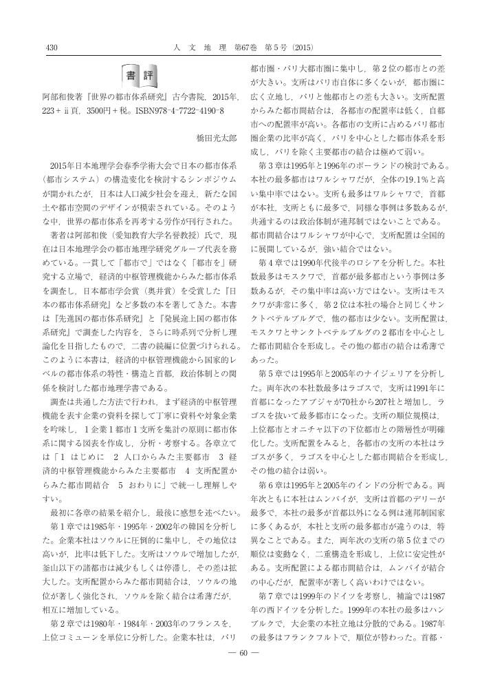
3 0 0 0 OA 阿部和俊著『世界の都市体系研究』
- 著者
- 橋田 光太郎
- 出版者
- 一般社団法人 人文地理学会
- 雑誌
- 人文地理 (ISSN:00187216)
- 巻号頁・発行日
- vol.67, no.5, pp.430-431, 2015 (Released:2018-01-30)
3 0 0 0 OA 産業集積地域における技術学習とその特性―新潟県燕市を事例として―
- 著者
- 江﨑 洋平
- 出版者
- 一般社団法人 人文地理学会
- 雑誌
- 人文地理 (ISSN:00187216)
- 巻号頁・発行日
- vol.64, no.5, pp.416-433, 2012 (Released:2018-01-24)
- 参考文献数
- 47
- 被引用文献数
- 1
The purpose of this paper is to examine the process and salient features of the technological learning pursued by private firms in an industrial agglomeration area and to elucidate the impact of this learning on the agglomeration. This industrial agglomeration involves the production of cutlery and other metal housewares, and it was formed in Tsubame, Niigata Prefecture. Since the 1980s, however, the firms in the city have entered new manufacturing fields or have developed new products by pursuing technological learning with the aim of acquiring the necessary technologies. Based on the accumulation of their own metal processing technologies, particularly for stainless products, these firms have attempted to develop new technology through trial and error. To overcome difficult issues that they cannot resolve themselves, the firms have cooperated with outside institutions such as related companies, universities, and official research organizations.Spatial expansion and diversification have been under way in this technological learning observed in Tsubame. This is because the search for sources for acquiring the technologies themselves has generally tended to expand to firms or universities beyond a particular agglomeration, and extensive activities of information collection to support technological development reflecting new market demand have become dominant. Such extensive and diverse technological learning from outside agents has given rise to the diversification of technologies within this agglomeration area and the enlargement of product variety, resulting in a diversity within this previously homogenous area. Meanwhile, the fact is that the present circumstances of new technology acquisition and new product development have not necessarily led to the growth of the agglomeration area as a whole.
- 著者
- 阪上 弘彬 渡邉 巧 大坂 遊 岡田 了祐
- 出版者
- 一般社団法人 人文地理学会
- 雑誌
- 人文地理 (ISSN:00187216)
- 巻号頁・発行日
- vol.72, no.2, pp.149-161, 2020 (Released:2020-07-23)
- 参考文献数
- 62
- 被引用文献数
- 1
欧米の地理教育・社会科教育では近年,古典的な地理情報システム(GIS)教育の代替案として提案された「空間的な市民性教育(Spatial Citizenship Education;以下 SCE)」が注目されている。本稿では文献研究を通して,欧米の地理教育・社会科教育における SCE の研究動向および特質を明らかにする。SCE では,空間,場所,スケール,権力,そして人間―環境関係といった地理の概念が重視されるとともに,社会的な意思決定プロセスに参加できる市民の育成が目指されている。その際に重要とされるのが地理空間情報や GIS をはじめとするジオメディアである。具体的な取り組みに関しては,初等・中等教育におけるジオメディアを用いた学習だけでなく,地理教師のためのコンピテンスや研修カリキュラムといった教師教育に関するものもみられた。SCE の動向の検討から,日本の地理教育・社会科教育においても,地理学者・地理教育の専門家と社会科教育の専門家によるそれぞれの専門性を踏まえた SCE 研究,教師教育の推進が不可欠である。
3 0 0 0 OA 大阪府和泉市のため池の変化と周辺住民のため池に対する意識
- 著者
- 猪原 章
- 出版者
- 一般社団法人 人文地理学会
- 雑誌
- 人文地理 (ISSN:00187216)
- 巻号頁・発行日
- vol.69, no.2, pp.229-247, 2017 (Released:2017-07-07)
- 参考文献数
- 27
- 被引用文献数
- 2 2
本稿では,営農状況や市街化の状況が異なる地区における,ため池と住民との関わり方が異なることを示し,農家・非農家を含む異なる住民集団間ならびに地区間でのため池に対する意識の多様さとその要因を解明する。調査対象地域は,ため池灌漑が営まれている,大阪府の南部に位置する和泉市である。和泉市では1970年代以降,大規模開発や宅地化が農家と農地の減少を引き起こし,それに伴って,潰廃されるため池と,非農家住民とが増加している。宅地化の度合いが異なる5地区で聞き取り調査と,3地区でアンケート調査を行った。その結果,以下の4点が明らかになった。第一に,営農状況や市街化の状況,集落規模といった要素が,ため池の利用や周辺住民との関わり方に影響を与えているが,その作用のしかたは地区によって多様である。第二に,住民の間では現在でも,ため池の用水機能が重視されている。第三に,現農家はため池と灌漑の維持への関心が高い一方で,非農家はため池の自然的な価値は認めているものの,ため池に対する関心が表面的である。この住民間の意識の差異には,日常的なため池との関わりや知識が影響している。第四に,地区間の意識の差異には,ため池に関する住民協働事業だけでなく,ため池の管理・整備状況や住民構成も影響している。
3 0 0 0 OA ジオデモグラフィクスを用いた教育水準の学校間格差の評価―大阪市を事例として―
- 著者
- 上杉 昌也 矢野 桂司
- 出版者
- 一般社団法人 人文地理学会
- 雑誌
- 人文地理 (ISSN:00187216)
- 巻号頁・発行日
- vol.70, no.2, pp.253-271, 2018 (Released:2018-07-02)
- 参考文献数
- 51
- 被引用文献数
- 1 2
本稿は,都市内での教育水準の空間的不均衡とジオデモグラフィクスに基づく居住者特性との関係を明らかにし,近隣地区における社会経済的要因の影響を除いた教育水準の学校間格差について評価するものである。対象地域として社会経済的な居住分化が比較的明瞭で,2013年から「全国学力・学習状況調査」(全国学力テスト)の学校別の結果が公表されている大阪市を選んだ。全国学力テストの平均正答率を教育水準とみなすと,都市の空間構造に対応した教育水準の不均衡が存在し,近隣スケールにおいてもジオデモグラフィクスに基づく社会地区類型と通学先の学校の教育水準には一定の関係が見出された。また社会地区類型間で教育水準格差が存在することも示唆され,社会地区類型の差異により学校間の教育水準の変動の約半分が説明された。そのため学校の教育水準の評価においてはその学校の置かれた地域条件を考慮することが不可欠であるといえる。さらに,実際の学力テストに基づいて計測される教育水準からこの地域条件の影響を取り除いた実質的な学校効果は,教育水準が高い学校ほど大きいことも明らかになった。これらの知見は,ジオデモグラフィクスが地域間や社会集団間の教育格差を明らかにするだけでなく,空間的公正の観点からそれらの格差解消に向けた政策ターゲットの特定においても有用であることを示すものであるといえる。
3 0 0 0 OA 土地所有からみた大阪駅周辺地区の形成と変化
- 著者
- 小原 丈明
- 出版者
- 一般社団法人 人文地理学会
- 雑誌
- 人文地理 (ISSN:00187216)
- 巻号頁・発行日
- vol.58, no.5, pp.504-520, 2006 (Released:2018-01-06)
- 参考文献数
- 42
There are many theories that deal with the processes of urban formation from the viewpoint of land-use and the location of services. Although it is also important to consider the processes from the viewpoint of land rights, not many studies have attempted this until now. Therefore, the purpose of this study is to consider the formation and the change of the area around Osaka Station through the analysis of transfers in land-ownership.The analysis in this study had three phases. First, the author investigated the transfer of land-ownership in the study area from 1945 to 1999. There were 4,063 transfers, of which 2,695 were land trades. Immediately after World War II, many lots were bought by individuals from land-owners who had possessed them before the war. The numbers of lots purchased by individuals decreased as time passed.Many corporations actively bought lots from the late 1960s to the first half of the 1970s and from the mid-1980s to the early-1990s. As these two periods represented booms in land trades, the same phenomena occurred throughout Japan. Moreover, the author believes that urban development around the study area stimulated land trades in the region. As a result, corporations owned 75% of the land in the area by 1999.Second, the author investigated where the buyers were located and their type of business. Many individuals who bought lots immediately after World War II lived in the same neighborhood. However, many of the real estate companies that bought a large number of lots in the late-1960s were companies that were located in Tokyo. In the late-1980s, real estate companies bought lots again, but this time many were located in Chou Ward, Osaka City. After the bubble economy burst, Tokyo companies again increased their ownership of land.Third, the author considered the acquisition processes of lots by Hankyu Corporation and Hankyu Realty Co., Ltd (real estate division of the Hankyu Corporation Group). These companies obtained many lots after World War II. Hankyu Corporation owns more than 10% of the land in the area. The lots that these companies own are unevenly distributed within the area. They commonly own many lots in Chayamachi. They have acquired these lots in order to enforce urban redevelopments. In particular, Hankyu Corporation has acquired the lots strategically, by entrusting other companies with their purchase.The significance of this study is to clarify the changes in land-ownership, which happened before land-use changes. After World War II, the structure of land-ownership in the study area changed from individual-based to one based on corporations. This change is highly likely to influence the development of the area as a business and commercial district. Judging from the number of land trades, the author suggests that the late-1960s were the turning point in that change, and supposes that the corporations that bought lots at that time developed the area.
3 0 0 0 OA アメリカにおけるエアリア・スタデイによる日本研究と日本の近代化
- 著者
- Yukiko N. Bedford
- 出版者
- 一般社団法人 人文地理学会
- 雑誌
- 人文地理 (ISSN:00187216)
- 巻号頁・発行日
- vol.32, no.6, pp.504-517, 1980-12-28 (Released:2009-04-28)
- 参考文献数
- 95
3 0 0 0 OA 寺内町の性格
- 著者
- 藤岡 謙二郎
- 出版者
- 一般社団法人 人文地理学会
- 雑誌
- 人文地理 (ISSN:00187216)
- 巻号頁・発行日
- vol.1, no.1, pp.41-47, 1948-06-01 (Released:2009-04-28)
3 0 0 0 OA 愛宕越えと東国の巡礼者
- 著者
- 田中 智彦
- 出版者
- 一般社団法人 人文地理学会
- 雑誌
- 人文地理 (ISSN:00187216)
- 巻号頁・発行日
- vol.39, no.6, pp.552-565, 1987-12-28 (Released:2009-04-28)
- 参考文献数
- 49
The Saikoku Thirty-three Kannons Pilgrimage is a folk-religious phenomenon and it attracted a number of pilgrims from most parts of the country during early modern times. Therefore it is very significant to study this pilgrimage from the view point of history of religions, cultural history, folklore, and especially historical-geography. Geographically, the Saikoku Pilgrimage, which consists of thirty-three sacred places called Fudasho, is united with a larger and organized sacred place as a whole called“The Saikoku Pilgrimage Place”.This study aims at reconstructing the two ordinary kinds of pilgrim routes from the 19th Fudasho, Ko Do Temple in Kyoto, to the 22nd Fudasho Soji Ji Temple in Ibaraki. One is the original and authorized rout between these Fudashos, and the other is the expanded and extraordinary route or Climbing Route over Atago Mountain. We compare them through the Tokoku pilgrims' records.As research materials we used the guide stones on the routes, the pilgrim's guidebooks, the illustrated pilgrim's maps, and the various records of pilgrims.As a results of this investigation we can conclude that the original pilgrim route from Yotsu Zuka in Kyoto to the 20th Fudasho, Yoshimine Dera Temple, is a relatively flat course. But the following section from Yoshimine Dera Temple to the 21st Fudasho, Ano Dera Temple in Kameyama takes a more steep course over the border mountains between Yamashiro and Tamba provinces and the next route from Ano Dera Temple to Soji Ji Temple is oals a steep course a cross the border mountains between Tamba and Settsu provinces.On the other hand, the Climbing Route over Atago Mountain begins from Seiryo Ji Temple, Kyoto, takes the same path through which people used monthly to visit the Atago Shrine on the top of Mount Atago, and then goes down towards Kameyama to arrive at Ano Dera Temple. The following section from Ano Dera Temple to Yoshimine Dera Temple is a reverse course of the original route. The route from Yoshimine Dera Temple to Soji Ji Temple follows the flat and comfortable Saikoku Highway, one of the main roads in that era in Japan.One pilgrim guidebook especially pointed out the lack of inns and resting houses on the original of the two routes, from Ano Dera Temple to Soji Ji Temple. But the Climbing Route over Atago Mountain has no such deficiency, but rather has many advantages along it through the path for the Atago Shrine and Saikoku Highway, which are different from the original route.By taking the Climbing Route over Atago Mountain, pilgrims could visit well-known and famous shrines or temples, for example, Komyo Ji Temple, Iwashimizu Hachimangu Shrine, Kannon Ji Temple, Hoshaku Ji Temple and so on.Moreover most of the guide stones confirmed by the author's observation point one way to Yoshimine Dera Temple, though some guide stones point two or more ways.These above mentioned facts seem to give a preference to the Climbing Route over Atago Mountain. According to their records, so many pilgrims from Tokoku in fact would go past the Climbing Route over Atago Mountain. Perhaps this route has been used since the Genroku Era.
3 0 0 0 OA 奈良県における戦後の開拓地の2類型
- 著者
- 西田 博嘉
- 出版者
- 一般社団法人 人文地理学会
- 雑誌
- 人文地理 (ISSN:00187216)
- 巻号頁・発行日
- vol.23, no.6, pp.658-669, 1971-12-28 (Released:2009-04-28)
- 参考文献数
- 15
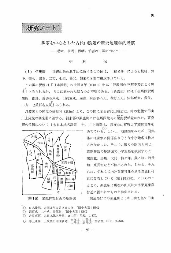
3 0 0 0 OA 駅家を中心とした古代山陰道の歴史地理学的考察
- 著者
- 中林 保
- 出版者
- 一般社団法人 人文地理学会
- 雑誌
- 人文地理 (ISSN:00187216)
- 巻号頁・発行日
- vol.23, no.1, pp.91-103, 1971-02-28 (Released:2009-04-28)
- 参考文献数
- 57
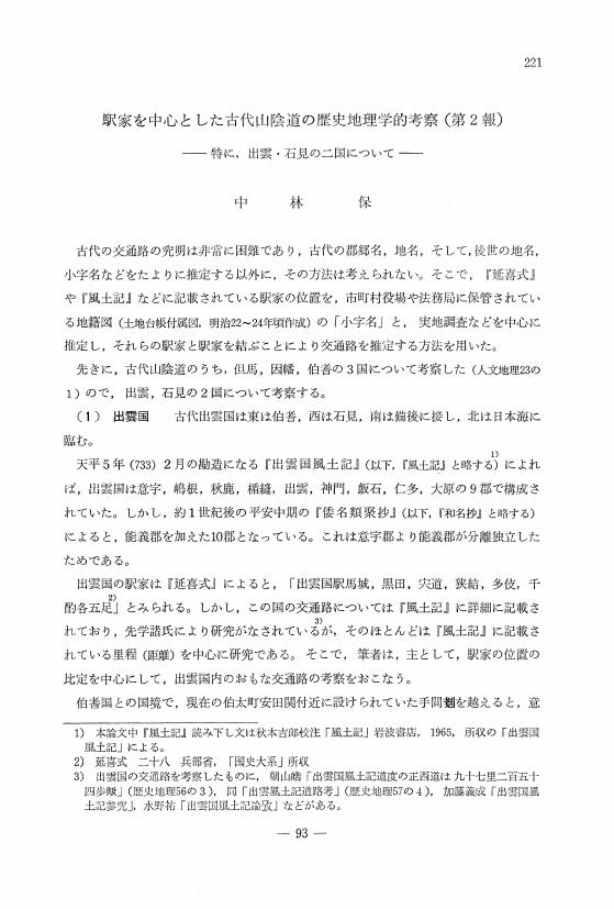
3 0 0 0 OA 駅家を中心とした古代山陰道の歴史地理学的考察 (第2報)
- 著者
- 中林 保
- 出版者
- 一般社団法人 人文地理学会
- 雑誌
- 人文地理 (ISSN:00187216)
- 巻号頁・発行日
- vol.24, no.2, pp.221-236, 1972-04-28 (Released:2009-04-28)
- 参考文献数
- 59
2 0 0 0 OA 社会関係資本に関する地理学の研究動向と課題―農業・農村研究との関連を中心に―
- 著者
- 寺床 幸雄
- 出版者
- 一般社団法人 人文地理学会
- 雑誌
- 人文地理 (ISSN:00187216)
- 巻号頁・発行日
- vol.68, no.4, pp.443-461, 2016 (Released:2018-01-31)
- 参考文献数
- 103
- 被引用文献数
- 2 2
本稿では,農業・農村研究との関わりにおいて社会関係資本の概念について再検討し,農村地理学の研究においてその概念に注目する意義と今後の研究の方向性を展望することを目的とする。さらに,英語圏での農村地理学,農村社会学で展開されるネオ内発的発展論の問題意識をふまえ,農村における農業の社会的側面を議論することが日本の農村,農業の持続可能性を考える際に重要であることを指摘する。社会関係資本の議論は1980年代以降に活発化し,パットナムの論考によって1990年代以降広く社会科学全体で行われるようになった。地理学分野でも,パットナムへの批判の後に議論が活発化し,その空間性や地域における影響をめぐって検討が進められた。さらに,地理学において関係論的視点が重視されるようになったことで,経済地理学を中心に社会関係への注目が高まり,社会的ネットワークとともに社会関係資本の重要性が指摘されるようになった。日本の農業・農村地理学においても社会関係資本に対する注目が高まっているが,それらは主に旧来の共同体的な結束型社会関係資本を中心に議論を進めている。橋渡し型社会関係資本との相互作用や,旧来の社会関係からの変化との関わりに注目する必要がある。さらに,社会関係資本に関する研究は量的研究が主流となっているが,構造的社会関係資本だけでなく,相互の信頼関係や共有される規範意識といった認知的社会関係資本についても注目して,質的研究を深化させることが重要である。
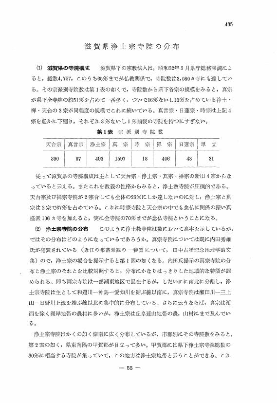
2 0 0 0 OA 滋賀県浄土宗寺院の分布
- 著者
- 伊藤 唯真
- 出版者
- 一般社団法人 人文地理学会
- 雑誌
- 人文地理 (ISSN:00187216)
- 巻号頁・発行日
- vol.12, no.5, pp.435-439, 1960-10-30 (Released:2009-04-28)
- 著者
- 小島 千佳
- 出版者
- 一般社団法人 人文地理学会
- 雑誌
- 人文地理 (ISSN:00187216)
- 巻号頁・発行日
- vol.75, no.2, pp.119-141, 2023 (Released:2023-08-22)
- 参考文献数
- 60
本稿は,文学作品の分析を通じて,ジェントリフィケーションにおける立ち退きをめぐる問題について,定性的な考察を試みるものである。英語圏のジェントリフィケーション研究では,聞き取り調査に依拠する定性的研究により,居住者の場所喪失という犠牲の経験が論じられつつある。本稿では,文学作品の表象分析を通じて,立ち退きに伴う登場人物の場所喪失を関係論的な場所論の視座から検討した。具体的にはジェントリフィケーションを描いた,ヤン・ブラントによる小説『街の中のとある住まい』を研究対象とし,主人公をはじめとした登場人物の場所喪失の描かれ方を分析した。その結果,主人公の場所喪失は一時的なものではなく,長期にわたる精神的苦痛を伴う過程として描かれていたことが明らかとなった。他方で,旧東ベルリン居住者やトルコ系住民の場所喪失との関係において,主人公は他者の場所喪失による痛みに無自覚であるばかりか,それをロマンチックな経験へと読み替える加害者としても描かれていた。本小説は,ジェントリフィケーションにより住まいが奪われる痛みを私小説形式で伝えるとともに,個人の経験に含まれる犠牲と加害との両義性を示している。しかし,本小説における主人公と他者の痛みの描写のように,場所喪失の経験を序列化する物語は,現実に起きているジェントリフィケーションに対する想像力を方向付け,立ち退かされる人々のあいだに分断をもたらし得るという問題を内包している。


