15 0 0 0 OA 亀岡断層帯の第四紀断層運動と地下構造
- 著者
- 岡田 篤正 植村 善博 東郷 正美 竹村 恵二 吉岡 敏和 堤 浩之 梅田 康弘 尾池 和夫 松井 和夫 杉森 辰次 杉山 直紀 園田 玉紀 梅田 孝行 松村 法行 山田 浩二 古澤 明
- 出版者
- 一般社団法人 日本活断層学会
- 雑誌
- 活断層研究 (ISSN:09181024)
- 巻号頁・発行日
- vol.2005, no.25, pp.93-108, 2005-06-30 (Released:2012-11-13)
- 参考文献数
- 36
The Kameoka basin is located to the west of the Kyoto basin. On the northeast side of the basin, two faults trending the northwest to southeast direction exist along the foot and the former edge of a mountain, respectively. They compose of the Kameoka fault zone with the length of about 13km (Okada&Togo ed.,2000).To elucidate such characteristics as distribution, subsurface structure and activity of those faults, we have carried out seismic reflections (P-waves) and deep drilling surveys across the faults. Volcanic ash and pollen analysis were also performed using core samples obtained by drillings. In this paper, we report the results of these surveys, especially about the characteristics of the concealed faults related to basin formation.By these surveys, three faults were detected along the three sections by the seismic reflection crossing the eastern half of the Kameoka basin, named as Fl, F2 and F3 faults from west to east. All faults incline to the northeast to form the reverse fault type uplifting to the northeast side.The Fl fault is concealed under the alluvial plain of the Katsura River and is an active fault having remarkable displacement of vertical direction to a few hundreds of meters. An accumulation of the displacement in the vertical direction is plainly recognized on the topographical and geological sections.The F2 fault appears in the wide deformation zone on the hanging. wall of Fl fault and is thought to be a subordinate fault of the F1 fault. From the distribution, the F2 fault is corresponded to be an active fault described by Okada&Togo ed. (2000) and identified at former edge of a mountain in the Kameoka basin. In this paper, we will call the Fl fault and the F2 fault as“ the Kameoka fault within the basin”. It is surely distributed about 4.6 km from the Umaji to the Hozu settlements in the southeast direction.Of the Kawarabayashi reflection profile, one reflection layer C has vertical displacement of 65m resulted from the activity of“ the Kameoka fault within the basin”. A pure seam from core samples of the layer is confirmed as so-called Oda Volcanic ash at 420-450ka. Therefore, the average slip rate of the vertical displacement is estimated at 0.15m per thousand of years or less, during the last about 430,000 years.We also found a fault scarplet (relative height 1.5-2.5m) on a low terrace. It seems to be formed by the F2 faulting since about 20,000 years ago. Hence the faulting of“ the Kameoka fault within the basin” since the late Pleistocene is certain, and also there is a possibility of the activity in the Holocene from the existence of the reverse-inclined terrace II at Umaji.Judged from distribution, the F3 fault is corresponding to "the Kameoka fault in the foot of a mountain" described by Okada&Togo ed. (2000). There is no evidence of the F3 faulting during the late Quaternary.
4 0 0 0 OA 琵琶湖湖底の活構造と湖盆の変遷
- 著者
- 植村 善博 太井子 宏和
- 出版者
- 公益社団法人 日本地理学会
- 雑誌
- 地理学評論 Ser. A (ISSN:00167444)
- 巻号頁・発行日
- vol.63, no.11, pp.722-740, 1990-11-01 (Released:2008-12-25)
- 参考文献数
- 40
- 被引用文献数
- 11
琵琶湖はわが国最大で,世界的にも最古の湖沼の1つであるが,その湖底部の活構造についてはほとんど明らかにされていない.そこで,湖沼図・ユニブーム記録・エアーガン記録の判読,深層ボーリングの成果などに基づき,湖底活断層の分布と性質,琵琶湖の傾動運動および現湖盆の変遷過程について考察した. その結果,湖盆形態を決定する大規模な活断層として,西岸・南岸・東岸湖底断層系が認定された.西岸湖底断層系はA級活動度をもつ最も重要な逆断層であり,変動地形や西傾斜の基盤面の特徴などから,琵琶湖を含む近江盆地のブロックが比良・丹波のブロックにアンダースラストしている境界であると推定した.南岸・東岸湖底断層系はB級活動度をもつ逆断層である..以上の活断層はその走向と変位様式から,東西水平圧縮下での共役断層系をなしていることが明らかになった.またこれらに限られた中・北湖盆は逆断層性の地溝(ramp vally)である。中央撓曲と掘削点断層は50万年前頃を境に変位速度が加速化しており,近畿中部全域において生じた地殻応力の増加が原因と考えられる.琵琶湖の湖底地形や堆積作用を支配している近江傾動運動は,約100万年前に発生し,40万年前以降加速化してきている.現琵琶湖盆の発達過程は,(1)湖盆の発生期(200万年前頃),(2)浅い湖盆の発達期(200万年~40万年前),(3)深い湖盆の形成期(40万年前~現在)の3時期に分けられ,その古地理図が描かれた.
3 0 0 0 OA 日本の禹王遺跡 ―治水神・禹王信仰と禹王文化―
- 著者
- 植村 善博
- 出版者
- 人文地理学会
- 雑誌
- 人文地理学会大会 研究発表要旨 2022年 人文地理学会大会
- 巻号頁・発行日
- pp.14-17, 2022 (Released:2022-11-30)
3 0 0 0 IR 1925年北但馬地震における豊岡町の被害と復興過程 (中井真孝先生古稀記念号)
- 著者
- 植村 善博
- 出版者
- 佛教大学歴史学部
- 雑誌
- 歴史学部論集 (ISSN:21854203)
- 巻号頁・発行日
- no.4, pp.1-18, 2014-03
The Kitatajima earthquake (M=6.8) hit at 11:10 a.m. May 23, 1925, and caused vast devastation of Toyookacho and Kinosakicho located on alluvial plain of River Maruyama,Northern Hyogo Prefecture.This happened in about one year and nine months after 1925 Kanto and before 1927 Kitatango earthquakes. This paper is aimed at discussing the cause of seismic damage and reconstruction process of Toyookacho from view point of comparison with 1925 and 1927 earthquakes. Conclusions are summarized as the followings: 1)Judged from degree and distribution of damaged houses, seismic intensity of the town was 6 degree, but Nagai located on newly reclaimed land and Odai located on abandonned channel were experienced up to 6high degree by more severe shaking resulted from soft ground. 2)Prefectural authorities quickly coped with rescue and temporal recovery,and claimed local governments to widen main roads and to perform land readjustment based on the lesson learned from Kanto earthquake. 3)Toyookacho tried to perform town planning of urban area by way of cultivated land reajustment,but was failed in it by strong opposition of landowners and temples. As a result, there had been left broad area with irregular and narrow roads 4)Reconstruction of Toyookacho is characterized by some remarkable achievements as follows. (1) As a street in front of station,Daikai Street (old Nagai douri)was widened 14.4m width with sidewalk and roadside tree both sides. (2)The civic center where city hall,post office,police station,tax office and firehouse were newly rebuilt,was completed as the only one example of reconstruction in Japan.(3)New anti-fire concrete buildings were encouraged, and there are many concrete buildings with unique design that are evaluated as cultural asset located along Daikai and Motomachi Streets.5)In Kitatango earthquake, Mineyamacho firstly decided widenning the roads in urban area instead of abandonment land readjustment. But, Aminoku of Aminocho was perfectly achieved land readjustment of residence area by way of cultivated land adjustment. These should be reflected the lesson learned from reconstruction process of Toyookacho in Kitatajima earthquake.seismic damagereconstruction processToyookacho1925 Kitatajima earthquake
3 0 0 0 OA ニュージーランド北島,パーマストンノース東部の海成段丘と第四紀地殻変動
- 著者
- 植村 善博 シエパード マイク
- 出版者
- The Association of Japanese Geographers
- 雑誌
- 地理学評論 (ISSN:13479555)
- 巻号頁・発行日
- vol.79, no.13, pp.769-785, 2006-11-01 (Released:2008-12-25)
- 参考文献数
- 29
- 被引用文献数
- 3 3
ニュージーランド北島,パーマストンノース東部の地形発達史および第四紀後期の地殻変動を明らかにする目的で海成段丘と河成段丘を調査した.その結果,トコマル段丘が海洋酸素同位体ステージ5eにあたる海成段丘であることを確定し,トコマル層の下位に位置する2層の海成層をそれぞれ海洋酸素同位体ステージの7および9の海進期堆積物に対比した.また,ステージ5以後の河成段丘であるフォレストヒル面,ミルソン面およびアッシュハースト面についてその形成年代と形成環境を明らかにした。トコマル段丘の旧汀線高度は109~147mにあり,その高度は南西へ0.3%の勾配で低下している.平均隆起速度は0.8~1.1m/kaである.また,トコマル面の縦断勾配は1.57~2.13%の勾配を持ち,北西方向に傾斜している.本地域では西北西への増傾斜運動が卓越しており,ワンガヌイ堆積盆地の沈降中心へ傾き下がる造盆地運動が支配的である.その増傾斜運動はトコマル面以降フォレストヒル面形成期までの間に比べ,フォレストヒル面形成以後に加速化した.
3 0 0 0 IR 『災害文化遺産 日本の禹王遺跡と治水神・禹王信仰展』の目的とその意義
- 著者
- 植村 善博
- 出版者
- 立命館大学歴史都市防災研究所
- 雑誌
- 歴史都市防災論文集 = Proc. of urban cultural heritage disaster mitigation (ISSN:18821766)
- 巻号頁・発行日
- vol.12, pp.275-280, 2018-07-14
1 0 0 0 OA 井上公夫:歴史的大規模土砂災害地点を歩く(そのII).
- 著者
- 植村 善博
- 出版者
- 公益社団法人 日本地理学会
- 雑誌
- 地理学評論 Series A (ISSN:18834388)
- 巻号頁・発行日
- vol.93, no.2, pp.107-108, 2020-03-01 (Released:2023-02-19)
1 0 0 0 OA 室戸台風による京都市の「師弟愛の像」建立とその変遷
- 著者
- 植村 善博
- 出版者
- 立命館大学歴史都市防災研究所 京都歴史災害研究会
- 雑誌
- 京都歴史災害研究 = 京都歴史災害研究 (ISSN:13493388)
- 巻号頁・発行日
- vol.20, pp.23-33, 2019
1 0 0 0 OA 1927年北丹後地震における京丹後市網野町網野区の被害要因と復興
- 著者
- 植村 善博 大邑 潤三 土田 洋一
- 出版者
- 公益社団法人 日本地理学会
- 雑誌
- 日本地理学会発表要旨集 2010年度日本地理学会秋季学術大会
- 巻号頁・発行日
- pp.76, 2010 (Released:2010-11-22)
研究目的 1927年の北丹後地震は郷村・山田両地表地震断層が共役的に出現し,変位地形や活動性から活断層の用語が日本で最初に使用され,地震断層沿いの集落で激甚な被害が発生したこと,などで注目される。地震学や活断層学的研究は進められてきたが,現状では被害分析,救援・救護、復興に関する研究は十分ではない(藤巻2000、追谷他2002など)。ここでは北丹後地震による竹野郡網野町網野区での被害発生の特徴と発生要因,および復興過程について調査し,新たにえられた結果を述べる。 調査結果 1)福田川低地の西縁に郷村断層下岡セグメントが出現した。この地表地震断層は沖積低地内をN20W走向で断続的に現れ,記載された変位量は左ずれ55cm(1カ所),東側隆起60~90cm(3カ所)である。市街地はこの地表地震断層から直線距離で東へ650~950m隔たっている。 2)網野区は海岸に砂丘列が発達する福田川の沖積平野下流に位置する。市街地は三方を古砂丘や旧砂丘列に囲まれ,西側は低湿地に接しており,市街地は逆三角形状の概形をなす。地下地質は沖積基底砂礫層の上に約30mの完新層が堆積しており,中部泥層(N値=1~3)の層厚は20~25mに達する。市街地の大部分は上部砂層(中粒砂、N=5~10)と上部泥層(シルト、N=1以下~3)の上に位置している。 3)網野区の被害状況は,人口2409人中死者199名,負傷者263名であり,全514戸中全壊477戸,全焼290戸であった(永濱1929)。約19カ所から出火し,市街地東半部を焼き尽くした。死亡率8.3%,全壊率92.8%,焼失率60.8%の値を示す。峰山町での死亡率(26%)全壊率(99%)と比較して前者が著しく低い原因は焼失が約6割にとどまり,住民が外へ逃げ出す余裕があったためと推定される。 4)網野区では区長森元吉らのリーダーシップを中心に独自の復旧・復興活動を進めることになる。翌8日に区の全7組長を招集し,被害を免れた森宅を区事務所として使用。10日に組長会を開き,区画整理と沈下地の埋め立を確認,11日までに組長が区画整理計画案もって住民間をまわり,ほぼ全員の承認をえた。5月24日には網野町第1耕地整理組合・震災復旧組合を設立。この間,地主や債権者の金融機関などの強い反対を粘り強い説得と毅然たる決意により乗り越えた。11月5日に網野区東部耕地整理組合(面積23町5反,組合員386名)が府の認可を受けた。1928年1月10日に着工,1929年10月30日工事完了した。整理後約4,100坪の減少となり,減歩率は8.1%である。工事経費の48,100円は,区補助12,000円,町助成金8,083円,その他組合員からの徴収分24,714円をあてた。 4)震災前の網野区は基準道路などは存在せず,無秩序・無計画な開発により発達してきた。耕地整理事業による都市プランは全38の方形ブロックを設定した。ただし、地形の制約から外周部は三角形など不整形なものが多い。典型的なブロックは100m×48~50mおよび80m×48~50mの区画をなし、これに24戸および20戸を割当て,全ての間口が通り面するように設定されている。本計画においては公園や緑地,シビックセンターなどは設置されなかった。
1 0 0 0 IR 京都盆地南部、木津川・宇治川の水害地形
- 著者
- 植村 善博
- 出版者
- 佛教大学文学部
- 雑誌
- 文学部論集 (ISSN:09189416)
- 巻号頁・発行日
- no.92, pp.29-43, 2008-03
"Gravel bar and Inner-bank pond called Oppori in Japanese are important flood landforms for research of alluvial plain and prevention of disasters of the Kizu and Uji Rivers, because they are indicators of the point of bank breaking and historical flooding. The author studies their location, present land use, origin and relationship between landforms and flooding. Inner-bank ponds had been about eighty during the past one hundred years, but are only three in April 2007, because of decrease by reclamation. Gravel bar were formed by debris flow or sandy mud flow, and are classified into A, B and C types in descending orders from their freshness and land use. Relationship between gravel bar, inner-bank pond and historical flooding in Seikacho, Kyotanabe City and Uji City were made clear since the eighteenth century. "gravel barinner-bank pondflood landformKizu and Uji Rivers
1 0 0 0 京都の治水と昭和大水害
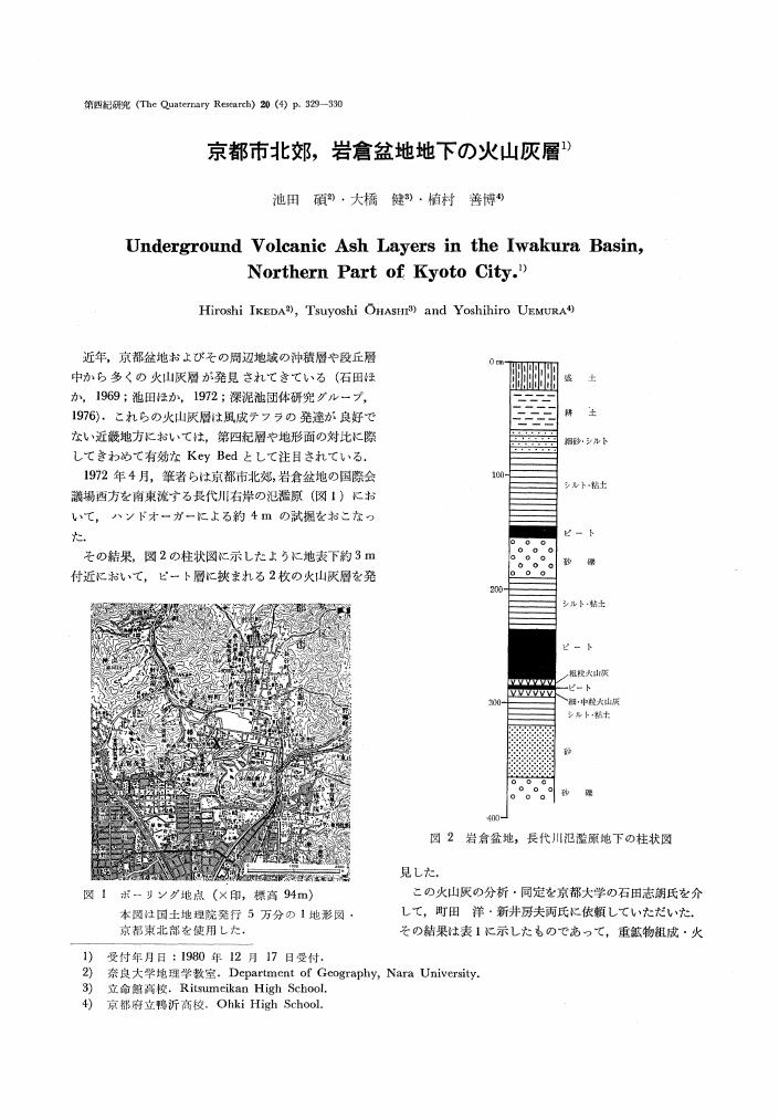
1 0 0 0 OA 京都市北郊, 岩倉盆地地下の火山灰層
- 著者
- 池田 碩 大橋 健 植村 善博
- 出版者
- Japan Association for Quaternary Research
- 雑誌
- 第四紀研究 (ISSN:04182642)
- 巻号頁・発行日
- vol.20, no.4, pp.329-330, 1982-01-20 (Released:2009-08-21)
- 参考文献数
- 8
1 0 0 0 1927年北丹後地震による京丹後市域の被害分析
- 著者
- 大邑 潤三 土田 洋一 植村 善博
- 出版者
- 公益社団法人 日本地理学会
- 雑誌
- 日本地理学会発表要旨集
- 巻号頁・発行日
- vol.2010, pp.75, 2010
I 研究目的<br> 北丹後地震は1927(昭和2)年3月7日(月)18時27分、京都府北西部の丹後半島を中心に発生したM7.3の地震である。震源の深さは極めて浅く、震央は旧中郡河邊村付近であると推測されている。丹後半島地域の被害が最も激しく、全体で死者2,925人、負傷者7,806人、住宅被害17,599戸であった。<br>本地震では郷村地震断層近傍の峰山町で約97%、山田地震断層近傍の市場村で約94%という高い住宅倒壊(全壊)率を示しており、地震断層近傍の地域ほど住宅倒壊率が高い一般的傾向であると言える。<br>しかしこれまで住宅倒壊率に関して小地域レベルでの詳細な検討がされてこなかった。そこで今回小地域レベル(大字)での分析を行った結果、一般的傾向にあてはまらない集落の存在が明らかとなった。本研究ではこれらの地域が一般的傾向に当てはまらない原因について、地震断層からの距離や地形・地盤などの観点から考察する。〈BR〉II 被害分析の結果 今回大字別の被害分析を行うにあたって『丹後地震誌』(永濱1929)の大字別被害統計を採用した。ここから各集落の住宅倒壊率の状況を示した地図と、地震断層からの距離と住宅倒壊率の関係を示した相関図などを作成した。これから総合的に判断して_丸1_地震断層辺遠で倒壊率の高い集落、_丸2_地震断層近傍で倒壊率の低い集落の2種類に分類し表1の通り抽出した。尚、山田断層周辺の集落に関しては比較・抽出が難しいので今回は割愛した。<br>相関図による分析を行った結果、地震断層からの距離と住宅倒壊率との関係は全体的に一般的傾向を示しながらも、かなり散らばる形となった。また比較する集落数の違いはあるものの、郷村地震断層下盤側の被害率が高い傾向にある事も明らかとなった。 <br>作成した地図から郷村地震断層の変位量と住宅倒壊率との関係を分析した。変位量の大きな郷村地震断層中部の被害率が高く、変位量が小さくなる南に移動するに従って被害率も低くなる傾向にあることを確認できた。<br>次に、表1に示した郷村断層東側分類_丸1_の仲禅寺などの4集落は、いずれも島津村の集落である。中でも仲禅寺・島溝川直近には仲禅寺断層が走っており、住宅倒壊率が高い原因が活断層による地質・地盤構造の急激な変化にある可能性が考えられる。また同じく島津村の掛津・遊両集落は砂丘地形に立地している。西側_丸1_浜詰村浜詰は浜堤上、木津村上野は砂丘周辺に立地しており、砂質地盤が倒壊率に大きく影響していると考えられる。<br>以上、地震断層辺遠で住宅倒壊率の高い集落は、いずれも地質・地盤状況に強く影響されていると考えられる。活断層の存在や地質・地盤状況が住宅倒壊率にどれほどの影響を与えたか、ボーリングデータなどからより詳細に分析する必要がある。またこれら特徴的な被害が発生した原因を地質・地盤のみに限定して求めることなく、盛土や建築物の構造など様々なレベルや視点から分析する必要性を感じる。
1 0 0 0 OA 地震災害研究と自然地理学
- 著者
- 植村 善博
- 出版者
- 一般社団法人 人文地理学会
- 雑誌
- 人文地理 (ISSN:00187216)
- 巻号頁・発行日
- vol.65, no.2, pp.167-180, 2013 (Released:2018-01-26)
- 参考文献数
- 38
- 被引用文献数
- 1
The Great Tohoku Earthquake of 2011 has posed questions for geographers concerning their awareness of and the contributions they can make to reducing damage in the future and to regional reconstruction in the wake of the gigantic devastation throughout the region caused by the earthquake disaster.There have been two periods of intense seismic activity in the western Pacific region. The first was during the period of the 1920’s to the 1930’s, and the other is from 1995 up to the present. Severe earthquake damage has occurred in Japan twice in 1925, in 1927, and in 1995; in Taiwan in 1935 and 1999; and in New Zealand in 1931 and 2011, all caused by inland earthquakes. The author has examined severe earthquake damage in the western Pacific Rim from a geomorphological viewpoint. Based on research of historical earthquake damage that occurred in the region, some important lessons were obtained and can be summarized as follows:1) Multi-scale analysis is essential for analyzing earthquake damage to buildings and its causes. Such analysis is also necessary for programs to mitigate damage that can be adapted to the appropriate scale.2) In order to mitigate direct damage by surface faulting we need to legislate land use controls in active fault zones. Additionally, an earthquake memorial museum should not only be for memorializing tragedy but also for education and as a tourist destination, and it needs to have content that is substantial.3) Governmental organizations for rehabilitation should be set up quickly after a disaster, and a comprehensive plan for reconstruction of a safer and more beautiful town must be presented as quickly as possible.4) It is necessary to move forward with research that grasps the entire process from the occurrence of an earthquake disaster up until reconstruction and includes an internationally comparative perspective.
1 0 0 0 小林善九郎関係文書調査報告書
- 著者
- 植村善博 奥田裕樹執筆・編集
- 出版者
- 京丹後市教育委員会
- 巻号頁・発行日
- 2014


